Current SPARC News
Teaching Resource: Reuse of archived digital 3D models for university students » By: Carla Klehm
The SPARC Program supports good practice in archiving of our projects in Zenodo (see "Consult Standards and Guidance" under the "LEARN" tab and "Research Outcomes" under the "ABOUT" tab). As the archiving of digital data continues to increase, questions surrounding the reuse of archaeological data has begun to emerge (see Kansa and Kansa 2018 here: https://doi.org/10.1017/aap.2018.7). With the Coronavirus disease pandemic resulting in many university courses being taught online, and fieldworks plans delayed, teaching resources for the use of archived data have become even more important. The SPARC team has developed a lesson plan that explores a collection of 3D models of ceramics from the 2014 "Boston Fingerprints" SPARC collaboration (Bagley, Poulsen, and Opitz). Over a series of five exercises, students will learn what 3D models are, how to use metadata to assess a 3D dataset's reusability for research, how to use to Meshlab and CloudCompare to visualize and analyze 3D data in different and informative ways. The teaching resource can be found at: https://github.com/castuofa/sparc_teaching
2020-11-02 17:55:05
What happens after a SPARC Project is completed? Research Outcomes, Finals Reports, and Archiving » By: Carla Klehm
SPARC follows the best practices in digital archaeology by making our results publicly accessible to the archaeological community and beyond. The Research Outcomes page of our website contains a list of the various publications, presentations, websites, and other outcomes from our previously funded SPARC Projects. Every SPARC project is required to submit a Final Report; these are also accessible on the Research Outcomes page and contain good information for new applicants on what a potential SPARC collaboration might entail. Lastly, the data from completed SPARC projects is eventually accessible in a stable, citable manner through publication on Zenodo, an open-source data repository hosted by CERN (see “Archived Material” on the Research Outcomes page). The archiving process is ongoing, so stay tuned for more!
2020-09-02 15:00:33
Publication Highlight: Least-cost path and viewshed analyses to model territorial boundaries » By: Carla Klehm
SPARC PI Nicholas Carter and colleagues published their article, “Country roads: Travel, visibility, and Late Classic settlement in the southern Mayan Mountains,” in the Journal of Field Archaeology (2019). Carter’s article explores the Late Classic (AD 600-830) Maya political landscape, where economic ambitions and physical landscape potential influenced settlement choice. Least-cost path and viewshed analyses helped model territorial boundaries, which therefore took into consideration control over travel corridors and settlement (inter)visibility. The model’s results indicate that access to travel routes were important, although not as crucial as in other long-distance exchange networks (e.g. the Silk Road). Further, Mayan capitals maintain visual control of travel routes and the greater Mayan countryside through clusters of sites with shared viewsheds. In all, the article provides a geospatial argument for supporting traditional Classic Mayan kingship best represents the Late Classic period. More information can be found at: https://doi.org/10.1080/00934690.2019.1571373
2020-09-02 14:49:32
Publication highlight: Hill et al. 2019, increasing GNSS use across the archaeological community » By: Carla Klehm
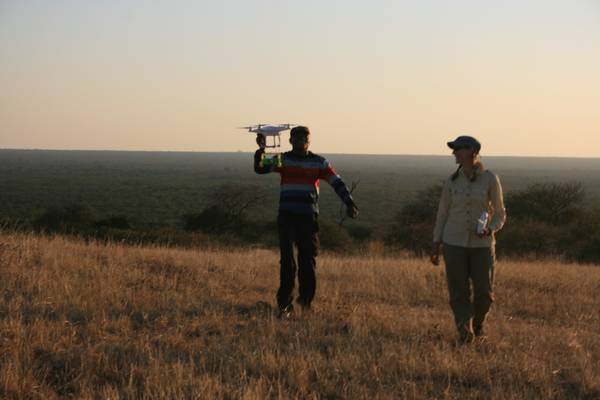
Members of the SPARC staff have been working to make spatial archaeometric methods more approachable for a broad set of archaeologists. As 3D documentation of objects and features—always an essential component of fieldwork—has improved greatly in the past several decades, precise survey data is available and applicable to a much wider range of archaeological projects. A new generation of high-precision, survey-grade global navigation satellite systems (GNSS) are allowing for better recording and analysis of artifact and feature proveniences, site and survey grid layout, and the production of topographic maps, among many uses. In their article, “A new era in spatial recording: Low-cost GNSS,” published in the journal Advances in Archaeological Practice, SPARC staff Austin (Chad) Hill, W. Fred Limp, Jesse Casana, Elise Laugier, and Malcolm Williamson detail the utility of one low-cost real-time kinematic (RTK) GPS/GNSS system, the Emlid Reach RS, whose cost (less than $1000) should be achievable for many archaeological projects. The article described the use, accuracy, and limitations of the Emlid Reach RS for archaeological fieldwork, and provides a link to workflow guides (also developed by Hill). More information can be found at: https://doi.org/10.1017/aap.2018.50.
2020-02-25 18:33:53
Publication highlight: Erb-Satullo et al. 2019, geophysics and UAV-based photogrammetry » By: Carla Klehm
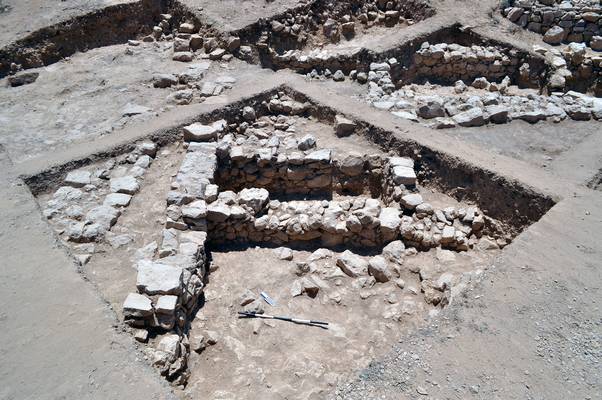
SPARC Project PI Nathaniel Erb-Satullo and colleagues published their article, “Investigating the spatial organisation of Bronze and Iron Age fortress complexes in the South Caucasus,” in the journal Antiquity, which seeks to understand socio-political processes in the South Caucasus (modern-day Georgia, Armenia, and Azerbaijan), c. 1500-500 BC. During this period, known as the Late Bronze Age and Early Iron Age, populations aggregated in fortified settlements across the landscape: a marked difference from the preceding Middle Bronze Age with mobile lifestyles and extensive, elaborate kurgan burials. What drew peoples to these places is a complex question, with implications for the comparative study of population aggregation across Eurasia. Erb-Satullo and colleagues were able to detect a "halo" of settlement and other activities beyond the main fortified hill, through a combination of magnetometry, UAV-based photogrammetry, surface mapping, and systematic surface collection, to better understand how and why these fortress-settlements emerged. More information can be found at http://dx.doi.org/10.15184/aqy.2018.191
2020-02-25 18:31:38
New Research Outcomes page » By: Carla Klehm
Fall 2019 marked the end of the 6th year of the SPARC Program. As SPARC has matured these last several years, our research outcomes have expanded tremendously, due in part to the long-term collaborative partnerships that the Program encourages. We are celebrating this occasion with the launch of a new webpage within the SPARC website (under our "About" tab) showcasing the publications, presentations, grants, and other web-based, non-traditional outputs that results from our projects, in order to increase their visibility to the archaeological community.
2020-02-25 18:24:34
Congratulations to the BosLand team on their new publication » By: Carolin Ferwerda
In summer 2017, SPARC supported Carla Klehm and the BosLand team in the project, “Bosutswe Landscapes Regional Survey: Building a Predictive GIS Model of Archaeological Sites in the African Interior.” This built off of a previous (2014) SPARC award, “Bosutswe Landscapes: Exploring early African towns through geophysics and photogrammetry.” The BosLand team and SPARC collaborators recently published the results of this work in an article, “Toward Archaeological Predictive Modeling in the Bosutswe Region of Botswana: Utilizing Multispectral Satellite Imagery to Conceptualize Ancient Landscapes,” in the Journal of Anthropological Archaeology. In the article, the authors describe how they used an algorithm to classify satellite imagery into 60 different categories and then interpreted the categories to identify probable archaeological sites of interest to the BosLand project, which focuses on the precolonial cities and kingdoms that arose in the African interior around the 1st millennium AD. The article is available here. Congratulations to authors Carla Klehm, Adam Barnes, Forrest Follett, Katie Simon, Christopher Kiahtipes, and Sarah Mothulatshipi!
2019-04-03 18:49:39
Upcoming online SAA Seminar with Fred Limp: Newer Developments in Technologies for the Measurement of Form and Space in Archaeology: Part II » By: Carolin Ferwerda
December 6, 2018 2-3pm EST More than 60 years ago, Gordon Willey famously stated that the objectives of archaeology are “approached by the study and manipulation of three basic factors: form, space and time.” Since then, we have seen the huge impact that improved technologies for the measurement of time have had on the field. We are currently in the midst of a similar revolution in the methods for the measurement of space and form. This lecture updates one first offered by SAA in 2014 and is designed as a state-of-the-art introduction to these developments, specifically for archaeology students. As a two-part series, Part II of this course examines analysis, display, and dissemination of High-Density Survey and Measurement (HDSM) data. Building on Part I, this lecture also provides further considerations and strategies for choosing the “best” approach in using these technologies. *FREE for individual SAA Members. Not available for SAA Nonmembers. Registered Professional Archaeologists will receive 1 Continuing Professional Education (CPE) credits for this course. Register HERE
2018-11-27 20:47:39
NSF support for SPARC renewed! » By: Rachel Opitz
Building on five years of continuous investment, the National Science Foundation has renewed funding for the Spatial Archaeometry Research Collaborations program, an initiative through the University of Arkansas, Dartmouth College and the University of Glasgow that acts as a national hub for geospatial research in archaeology. The $188,545 grant supports the SPARC program, which provides research and technical expertise to archaeological research projects working with a variety of technologies, including 3-D survey and modeling, geospatial analysis and visualization, and geophysical and airborne remote-sensing. Building on successful collaborative research projects, in 2017-2018 recipients of SPARC awards, together with their collaborators from the SPARC team, published the results of innovative spatial archaeometric work in Geosciences and the Journal of Field Archaeology. The SPARC team also began an initiative to make completed project’s data accessible via publication on Zenodo, an effort that will continue in the coming year. Looking to future work, SPARC is collaborating with the MicroCT Imaging Consortium for Research and Outreach (MICRO) at the University of Arkansas to support projects undertaking high resolution imaging of objects and samples, growing the program’s capacity to support data and analytics projects. The SPARC program was created by the Center for Advanced Spatial Technologies and the Archaeo-Imaging Laboratory with a $250,000 grant from the NSF in 2013. The program offers direct support to archaeological projects through awards in fieldwork, data and analytics, and publication. In addition to collaborating on research projects directly, SPARC helps researchers learn about the latest technologies and their archaeological applications through residencies at the Center for Advanced Spatial Technologies or through online resources and periodic webinars. For many decades, space has been viewed as one of the central dimensions of archaeological study, from artifacts to landscapes, and SPARC supports a wide variety of collaborators and projects around the world. Researchers at the Center for Advanced Spatial Technologies have collaborated on 29 projects worldwide, including working with Michael Harrower to conduct geophysical survey in Oman, with Steve Wernke and Parker VanValkenburgh to develop the GeoPACHA platform (Geospatial Platform for Andean Colonial History and Archaeology), and Andrea Brock to model the ancient topography of the Roman Forum Boarium . A full list and complete descriptions of recent awards can be found on the SPARC website. Recent publications resulting from SPARC Projects include: Dolan, Patrick, Colin Grier, Christine Markussen, and Katie Simon. "Magnetic Gradient Survey of the Marpole Period Dionisio Point (DgRv-003) Plankhouse Village, Northwest Coast of North America." Journal of Field Archaeology 42, no. 5 (2017): 437-449. Wiig, Frances, Michael Harrower, Alexander Braun, Smiti Nathan, Joseph Lehner, Katie Simon, Jennie Sturm et al. "Mapping a Subsurface Water Channel with X-Band and C-Band Synthetic Aperture Radar at the Iron Age Archaeological Site of ‘Uqdat al-Bakrah (Safah), Oman." Geosciences 8, no. 9 (2018): 334.
2018-09-25 14:27:04
Congrats to the Dionisio Point team on their new publication » By: Rachel Opitz
In 2014 SPARC supported Patrick Dolan and Colin Grier in their project, "The economic organization of a pre-contact Northwest Coast village". The team and their SPARC collaborators recently published the results of their work in an article, "Magnetic Gradient Survey of the Marpole Period Dionisio Point (DgRv-003) Plankhouse Village, Northwest Coast of North America" in the Journal of Field Archaeology. You can read the article here. Congrats to authors Patrick Dolan, Colin Grier, Christine Markussen & Katie Simon!
2017-09-25 08:22:54
NSF Renews Support for SPARC » By: Rachel Opitz

The SPARC team is happy to announce that the NSF has awarded the Program a $158,762 grant to support its activities in 2017-2018. SPARC will continue to provide research and technical expertise to archaeological researchers working with a variety of technologies including 3-D survey and modeling, geospatial analysis and visualization, and geophysical and airborne remote-sensing. In 2017-2018 the SPARC will focus on analytical and publication projects. Updated information on application deadlines for 2017-2018 will be available soon. Full details on the NSF award are here.
2017-08-30 06:54:13
Congratulations to the SPARC Award Recipients for Spring-Summer 2017 » By: Rachel Opitz
We are proud to announce the next group of projects supported by SPARC Awards. In Spring-Summer 2017 SPARC will collaborate with four new projects, undertaking a variety of analytical projects. Congratulations to all the project leaders!
Developing GeoPACHA: Geospatial Platform for Andean Culture, History, and Archaeology
This project will contribute to the development of GeoPACHA (Geospatial Platform for Andean Colonial History and Archaeology), a geospatial database and interface for producing thematic and analytical maps, currently being created by the PIs with support of the NEH (award #HD-229071-15) and Mellon Foundation. The SPARC collaboration will support adding the ability to crowdsource the locations of previously unmapped reducciones in the territory of the Viceroyalty of Peru through “virtual archaeological survey” using high resolution satellite imagery. The project will focus on using free and open source software in creating the geospatial infrastructure, enhancing the reproducibility of the approach.
- PI: Steven Wernke
- Institution: Vanderbilt University
- Co-PI: Nathaniel (Parker) VanValkenburgh
- Instituion: Brown University
- Region: South America
Bosutswe Landscapes Regional Survey: Building a Predictive GIS Model of Archaeological Sites in the African Interior
(Image credit: Mica Jones) The Bosutswe Landscapes Regional Survey (BosLand) began in 2014 to works towards a better understanding of the precolonial cities and kingdoms that arise in the African interior around the 1st millennium AD. This project focuses on building a GIS to integrate extensive, newly acquired, satellite imagery for the study region with data collected from previously collected geophysical and close-range aerial data. The project's GIS will also bring together information on sites with that on local water systems. The project also aims to develop a predictive model for sites in other nearby areas. The PI (Klehm) would like to acknowledge the DigitalGlobe Foundation for their support in the upcoming project through an Imagery Grant. The SPARC Analytics project uses, in part, previously collected survey and excavation data in 2014. To this effect, the PI would also like to acknowledge the support of East Tennessee State University (under a RDC Major Research Grant) and, jointly, the Center for Advanced Spatial Technologies at University of Arkansas and National Science Foundation (through a SPARC Fieldwork Grant). The geophysical component of this previous field research was led by Dr. Eileen Ernenwein East Tennessee State University, the aerial survey by Katie Simon at University of Arkansas, under the direction of Carla Klehm and with archaeological assistance from the University of Botswana and the National Museum of Botswana. The 2014 data were collected under Republic of Botswana Ministry of Environment, Wildlife, and Tourism Permit EWT8/36/4XXV(62).
- PI: Carla Klehm
- Institution: Washington University in St. Louis
- Region: Africa
Using Total Viewsheds to Evaluate Visibility in the Placement of Chacoan Monumental Architecture
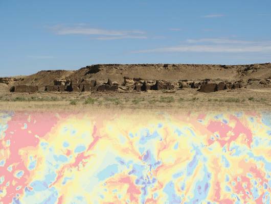
This project seeks to answer a series of questions related to the visual environment of Chacoan monumental architecture. The projects key questions are: 1) To what extent were great houses and other Chacoan structures positioned to maximize their visibility within local landscapes? 2) Did the choices about visibility made by the builders of great houses change over time and/or differ among regions? The project will approach these questions through the use of total viewsheds, building on work done as part of the Chaco Social Networks (CSN) Project. The project gratefully acknowledges support from the Chaco Social Networks Project, which was funded by the National Science Foundation (grant numbers 1355374 and 1355381) and the Chaco Research Archive, which supplied essential data.
- PI: Katherine Dungan
- Institution: Archaeology Southwest
- Co-PI: Sylviane Déderix, Kristin Safi and Devin White
- Instituion: University of Arizona and Oak Ridge National Lab
- Region: North America
Stagville Landscapes via LiDAR
The Stagville Landscapes project will examine the nearly 20,000 acres of plantation lands owned by the Cameron family of North Carolina from 1776 through the middle of the 20th century. The project represents an important opportunity to examine a single plantation complex in its entirety. The results, based on a combination of LiDAR analyses and archival research, will contribute to our understanding of the social relations and human-environment relations that characterized plantations—networked spaces of labor.
- PI: Anna Agbe-Davies
- Institution: University of North Carolina, Chapel Hill
- Region: North America
2017-01-10 14:01:15
Apply for SPARC Spring - Summer2017 Awards - November 19th Deadline » By: Rachel Opitz
Applications for SPARC Spring - Summer 2017 Season are now open. We are accepting applications for projects in the "Data & Analytics" and "Archiving & Publication" categories. The target dates for these projects are March- August 2017. We are currently available for pre-application consultations and we encourage you to contact us by email at sparc@cast.uark.edu to discuss your project idea. Applications can be submitted through the program website: http://sparc.cast.uark.edu. The application deadline is 19 November 2016 - coming up soon!
2016-09-25 13:14:37
Congratulations to the SPARC Award Recipients for Winter 2016-2017 » By: Rachel Opitz
Since 2014 the SPARC Program, based at the University’s Center for Advanced Spatial Technologies (CAST), has helped archaeological researchers use geospatial methods and technologies in their work. To date, SPARC has supported over a dozen projects around the globe, selected through a competitive Awards program. In Winter 2016-2017 SPARC will collaborate with four new projects, undertaking fieldwork projects in the around Africa and the Near East and a lab-based analysis of landscapes and routeways in Anatolia. We are proud to announce the next group of projects supported by SPARC Awards. Congratulations to all the project leaders!
Modeling Royal Architecture at Sans Souci, Haiti: 3D Scanning and Photogrammetry at a UNESCO World Heritage Site
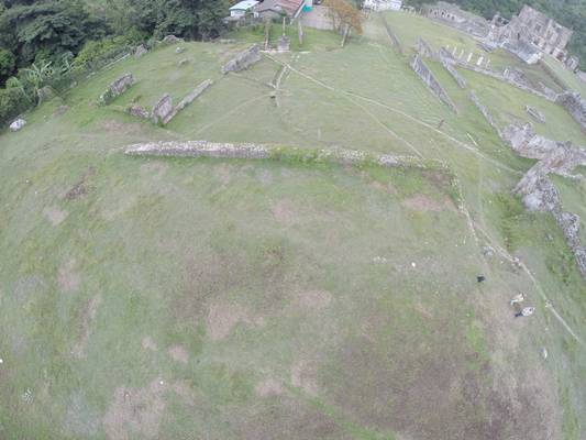
CAST researchers will be collaborating with Dr. Monroe and Mrs. Rocourt to collect new 3D scanning and photogrammetric data of the standing architecture at San Souci, Haiti to generate a high resolution architectural and topographic plan of the site. The collection of this data is crucial to the PIs examination of the architecture of power in the short-lived Kingdom of Haiti (1811-1820), which emerged in the years following the Haitian Revolution. The new project builds on an earlier program of geophysical survey centered on the main palace, and supports the completion of the preliminary study of the site, generating baseline data with which to begin to ask broader questions about the organization of space at this important and under-studied site, and the social dynamics expressed and created by the spatial arrangements.
- PI: Cameron Monroe
- Institution: University of California – Santa Cruz
- Co-PI: Monique Rocourt
- Instituion: Institut de Sauvegarde du Patrimoine National
- Region: Caribbean
Mapping the growth of land-route networks across Anatolia
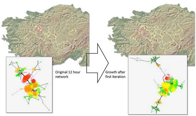
Mr. Stephens will collaborate with the CAST team to undertake high resolution path modeling and network analysis to investigate routeways emerging and in use in Anatolia in the Early Iron Age (ca. 1100-800 BCE), following the collapse of the Hittite state ca. 1200 BCE. This work will support the PIs ongoing research that seeks to understand the complex web of relationships that developed across Iron Age Anatolia through an integrated study of possible land-routes determined by topography and principles derived from network analysis. The results of the project will shed light on territorial issues of state formation and test the effects of large, dominant centers on the arrangement of evolving transportation networks.
- PI: Lucas Stephens
- Institution: University of Pennsylvania
- Project Type: Analytics
- Region: Near East
Turning the Landscape into a Stela: The Mechanics of Egyptian Royal Rock Inscriptions
Ms. Thum will collaborate with researchers from CAST to create detailed and georeferenced 3D models of Egyptian inscriptions carved into the stone and their immediately surrounding landscapes in a variety of locations in the Middle East and North Africa that fall within the sphere of Egyptian influence. Through this analysis the research team will investigate potential cultural, religious, and military motivations behind the placement of living-rock monuments on particular outcrops and in the wider landscapes around them and to assess whether spatial language within the texts of living-rock monuments might have played a role in articulating their positions in the landscape.
This project gratefully acknowledges the support of the Council of American Overseas Research Centers (CAORC), the Andrew W. Mellon Foundation, the American Research Center in Egypt (ARCE), and the United States Department of State Bureau of Educational and Cultural Affairs.
- PI: Jennifer Thum
- Institution: Brown University
- Co-PI: Parker Van Valkenburgh
- Instituion: Brown University
- Region: Near East and North Africa
FUNDED: Architectural Sequences in the Shire Region
Together with SPARC researchers, Drs. Wendrich and Barnard and Ms. Moy will undertake geophysical survey and analysis of archaeological remains dating to the Aksumite Period across an occupation area around the sites of Mai Adrasha and Mezebar Adimenabr (Ethiopia). The material culture of this period and region is relatively unknown, and the results of the project will provide essential basic archaeological data. The team plans to focus their investigations on the variability of domestic architecture. Patterns and distributions of domestic architecture types will be used to elucidate differences in identity or activities within the context of a community developing new agricultural practices and in the process of urbanization.
- PI: Willeke Wendrich
- Institution: University of California – Los Angeles
- Co-PI: Hans Barnard and Rachel Moy
- Instituion: University of California – Los Angeles
- Region: Africa
2016-07-19 20:14:22
Application deadline extended for winter 2016 / spring 2017 projects - now May 23 » By: Rachel Opitz
The application deadline for winter 2016 / spring 2017 projects has been extended to May 23. Contact us at sparc@cast.uark.edu to discuss an application.
2016-05-04 21:16:31
Busayra Project publication in the Antiquity Project Gallery » By: Rachel Opitz
Congratulations to the Busayra team for publishing an initial report on their work at Busayra with Antiquity! You can read about the project here: http://antiquity.ac.uk/projgall/564.
2016-04-11 20:48:00
Applications open for winter 2016-2017 SPARC Projects » By: Rachel Opitz
Applications are now being accepted for winter 2016-2017 SPARC Projects. Contact us at sparc@cast.uark.edu to discuss your project idea. The deadline for fieldwork and analytical project proposals is May 6.
2016-04-01 21:01:41
New SPARC Projects in Spring and Summer 2016 » By: Rachel Opitz
We are proud to announce the next group of projects supported by SPARC Awards. These projects will take place throughout spring and summer 2016. Congratulations to all the PIs.
Geospatial Analytics at Gast Farm, a Multicomponent Site in the Upper Mississippi River Valley
Drs. Green, Whelan, Doershuk, and Swanson will be collaborating with SPARC researchers to develop a GIS and integrate the diverse data collected through their ongoing investigation of Gast Farm, a 13-hectare prehistoric site complex located in southeast Iowa. This site is important for the understanding of Middle and Late Woodland settlements’ spatial organization, ritual behavior, regional interaction, and social complexity. The project will bring together information from vertical and oblique air photos, airborne lidar data, surface survey, excavation and geophysical surveys. Students will be actively involved in this project, receiving training in GIS design and geospatial analysis.
- PIs: Drs. William Green, Susan Swanson, Mary Whelan, and John Doershuk
- Institutions: Beloit College, Arizona State University, University of Iowa
- Project Type: Analytics
- Region: North America
Five Lands Geospatial Project
Dr. Carter, together with Ms. Santini and Mr. Davenport, will collaborate with SPARC researchers to study the relationships between terrain, routeways, and evolving settlement patterns in the Five Lands region during the Classic period of Maya culture history. The project will assess the relationships between intervisibility and visual position, travel cost, and regional settlement structure in a rugged yet highly interconnected landscape. Specifically, the locations chosen for the establishment of new capitals will be considered in light of existing settlements and the need for access to and control over travel routes that allow for participation in the trade of prestige goods. The team will acquire relevant topographic and land cover data, integrate information on the locations of known sites and economic connections, and carry out visibility and cost-surface analyses.
- PIs: Dr. Nicholas Carter, Ms. Lauren Santini, and Mr. Bryce Davenport
- Institutions: Harvard University and Cultural Site Research and Management
- Project Type: Analytics
- Region: Central America
Marzuolo Archaeological Project: Crafting Innovation and Community in The Roman Countryside
Drs. Vennarucci, Van Oyen and Tol will work with SPARC researchers to implement a digital recording system for the excavations at Marzuolo, a rural production site located in Tuscany, Italy. Supported through pre-fieldwork and on-site collaboration, the team at Marzuolo will establish a method for creating detailed georeferenced 3D models of their sites stratigraphy, integrated with the projects broader GIS and descriptive data. By enabling accurate and thorough spatial recording, the collaboration will aid the PIs in their investigation of the spatial organization of the site and its production activities, particularly those linked to the experimental and later standardized production of Terra Sigillata Italica pottery.
- PIs: Drs. Rhodora Vennarucci, Astrid Van Oyen and Gijs Tol
- Institutions: University of Arkansas, Cambridge University, University of Groningen
- Project Type: Fieldwork
- Region: Mediterranean Europe
Reconstructing the Environment and Topography of the Forum Boarium in Rome
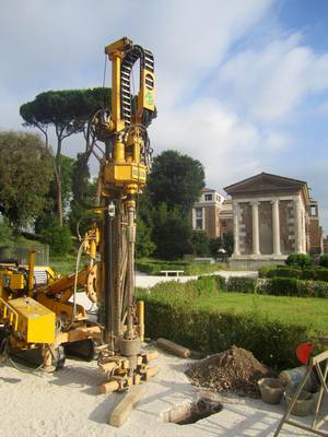
Together with SPARC researchers, Ms. Brock will use newly acquired data from her coring survey to build a digital model of the temple complex at Sant’Omobono (Rome, Italy) and the adjacent Tiber River harbor. By reconstructing the natural and built environment of this area, the team will explore the development of Rome’s river harbor in the context of an emerging city. The modeling process will support research on the role of the environment and human adaptation in prehistoric urban systems, and the results will provide an effective way to communicate the new picture of the Forum Boarium.
- PIs: Ms. Andrea Brock
- Institutions: University of Michigan
- Project Type: Analytics
- Region: Mediterranean Europe
Craft Production and Technological Change at Fortress Sites in the South Caucasus, c. 1500-500 BC
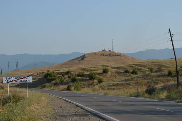
Through this collaborative project, Mr. Erb-Satullo and members of the SPARC team will carry out geophysical surveys at Mtsvane Gora (Republic of Georgia). The project aims to identify and understand the spatial distribution of metallurgy activities and extra-mural settlement at the site. The elucidation of these patterns will support Mr. Erb-Satullo’s research on the social context of early iron production, as reflected in the spatial relationships between domestic areas, workshops, and public areas. The results of this research will contribute to the PIs broader work on control of metal production, technological change, social hierarchy and settlement in the context of the Bronze Age – Iron Age transition in Georgia.
- PIs: Mr. Nathaniel Erb-Satullo and Dr. Jason Ur
- Institutions: Harvard University
- Project Type: Fieldwork
- Region: Caucasus
2015-12-17 04:32:57
SPARC/SLAM Project publishes research results in the Journal of Field Archaeology » By: Rachel Opitz
We are proud to announce the publication of results from the "Lidar data acquisition and landscape archaeology for the Caribbean island of Montserrat" project, led by PIs John Cherry and Krysta Ryzewski, in the Journal of Field Archaeology. The Survey and Landscape Archaeology on Montserrat (SLAM) project began in 2010, and through an award from the SPARC Program they began to use Airborne Laserscanning (ALS) data as the basis for their prospection strategy. The results of the first season of fieldwork carried out by the SLAM team, using the ALS data and visualizations prepared by the SPARC team, are now available on the JFA website. Check out the article, "Using Airborne LiDAR Survey to explore Historic-era archaeological landscapes of Montserrat in the Eastern Caribbean" at: http://dx.doi.org/10.1179/2042458215Y.0000000016.
2015-09-15 14:08:32
New Application Deadlines » By: Rachel Opitz
Application opening dates and deadlines for submission are changing for 2016 projects. Applications for projects from March-August 2016 will open on the 15th September 2015 and the deadline for submission will be the 6th November 2015. Contact us at sparc@cast.uark.edu for more information.
2015-07-04 03:21:12
SAA Forum on Diverse Digital Archaeologies » By: Rachel Opitz
Members of the SPARC team will be participating in the "Diverse Digital Archaeologies" Forum at the SAA Annual Meeting on Thursday morning, April 16th 2015, in San Francisco. This is a CAA-NA and DDIG sponsored event. The moderators will be Rachel Opitz and Joshua Wells and discussants will be Michael Ashley, Lisa Fischer, Douglas Gann, Timothy Goddard, Shawn Graham, Sarah Kansa, Francis McManamon, Katy Meyers Emery, Eric Poehler, Maria Raviele, Heather Richards-Rissetto, and Ash Scheder Black.
Diverse Digital Archaeologies - A CAA-NA & DDIG event
The Digital Archaeology community is growing. The methods, practices and research activities drawing on and contributing to the domain continue to expand, including everything from geophysical surveys to agent based modeling to text mining to ontology development to multimedia presentations of public heritage projects. This forum takes advantage of the diversity and breadth of interests of the digital archaeologists present at the SAA to exchange ideas and discuss key developments and new directions.
In this forum discussants will briefly (10 minutes) present their digital archaeology research and articulate how their work contributes to the broader domain. Presentations will be followed by a general discussion of the advantages and challenges of the diversity of digital archaeology, focusing on ways to bring together digital archaeologists working on different types of projects and promote communication. This forum aims to create the foundations for ongoing conversation between various specialists, interest groups and stakeholders within the SAA, CAA and the Digital Archaeology community at large.
For more information see the SAA conference website .
2015-03-18 14:34:31
PAST WORKSHOP: 3D Data Capture and Integration Workshop at UBC Vancouver » By: Rachel Opitz
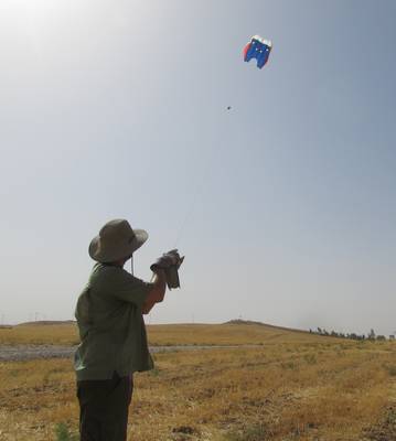
SPARC is supporting an intensive, hands-on two day workshop at UBC Vancouver, March 12-13, 2015. During this workshop participants will learn how to use Structure from Motion techniques to create 3D models, perform basic analysis of the resulting models, and present them on the web. This workshop is designed for archaeologists, but may be of interest to museum professionals, artists, and anyone interested in digital 3D technologies. For more information see http://tinyurl.com/mdo3f36.
2015-03-11 09:12:19
SPARC Awards for Spring and Summer 2015 » By: Rachel Opitz
We are proud to announce the third group of projects supported by SPARC Awards. These projects will take place throughout spring and summer 2015. Congratulations to all the PIs.
Data-fusion of a multi-instrument geophysical survey of an Iron Age Iberian/Roman settlement
Wendy Cegielski (ASU), with co-PIs Justin Rego and Ignacio Grau-Mira will be collaborating with SPARC researchers to investigate the structure and organization of the urban, Iberian fortified settlement of Mariola in Eastern Spain. Mariola’s occupation spans the 2 and 1 centuries BC, a period marking the first stage of Roman control of Eastern Iberia, before the direct implantation of Roman Towns in the 1 century AD. This project’s The coPI’s have collected a large, multi-instrument dataset including gradiometry data with almost full coverage of the site area supplemented by sampled conductivity and susceptibility data. The PIs will work with SPARC researchers to pursue advanced datafusion techniques and the integration of LiDAR imagery. The aim is to improve current methods for distinguishing features of interest on Iberian fortress sites, and to undertake a more elaborate analysis of the data available, to identify of household structures and other traces of the urban plan, and to interpret their incorporation of Roman and Iberian structural features. These results will be compared to the settlement plans of other Iberian fortresses in the region in order to increase our understanding of the process of Roman Imperialism in Iberia.
We would like to acknowledge the University of Alicante Spain, the Museu Arqueològic Municipal in Alcoi Spain, Dr. Ignasi Grau-Mira, and the 2014 Mariola Field School as hosts and assistants with the geophysical survey. We also thank Geoscan Research and Dr. Lew Somers for technical assistance and supplies and Dr. Jay K. Johnson from the University of Mississippi for the geophysical instrumentation.
- PIs: Wendy Cegielski (ASU), with co-PIs Justin Rego and Ignacio Grau-Mira
- Institution: Arizona State University and University of Alicante
- Project Type: Anayltics
- Region: Mediterranean Europe
Understanding Rejolladas and Examining their Potential for Predicting Settlement Location at Tahcabo, Yucatán, México
Professor Patricia McAnany and Maia Dedrick of UNC Chapel Hill and Dr. Adolfo-Iván Batún-Alpuche (AGEY) will be collaborating with SPARC researchers to seeks to identify the size and distribution of rejolladas (limestone solution sinkholes) on commonly held ejido land surrounding the town of Tahcabo, Yucatán, México. Rejolladas are significant landscape features because they generally contain deep soils and are characterized by high humidity, in contrast to their surroundings, characterized by shallow surface soils that mean that in northern Yucatán many culturally important tree crops—such as cacao—can only be grown in rejolladas. Further, this difference in soils means that long occupational sequences and information on changes in land use and crop regimes will likely come from rejolladas rather than shallow surface excavations. In this project the collaborators will use remote sensing data to identify and characterize the rejolladas in the area around Tahcabo and to use the results of the mapping exercise to construct a predictive model of settlement location. Further study will examine the attractiveness of rejolladas, and whether such attractiveness was spatially or temporally contingent. The research will also support archaeobotanical and ethnobotanical research by the co-PIs.
- PIs: Professor Patricia McAnany and Maia Dedrick and Dr. Adolfo-Iván Batún-Alpuche
- Institutions: UNC Chapel Hill and AGEY
- Project Type: Analytics
- Region: Central America
Malthi Mapping and Digitization Project
Malthi provides a nearly unique example of a fully excavated Middle Hellenic (MH) settlement. The excavated remains include a series of houses, storage facilities, entrance ways, and possible public architecture, enclosed by a settlement wall. Malthi is perhaps the first MH site at which a major restructuring of the settlement architecture was observed, as proposed by Valmin. The PIs research focuses on the socio-cultural motivations for the decision to make substantial revisions to the urban layout, as well as impacts on the life of the settlement and the surrounding area. PIs Rebecca Worsham, Prof. Donald Haggis, and Prof. Michael Lindblom will be collaborating with SPARC researchers to produce an accurate and analysis-ready plan of the exposed standing remains and a digital elevation model (DEM) of the settlement at Malthi, using a combination of scanning and structure from motion techniques. This work in embedded in a larger project, and aims to reconsider the architecture of the site including prior identifications of room types (by Valmin), and to attempt to identify coherent buildings. This improved survey, mapping and interpretation exercise will support a rethinking about the settlement’s organization, and re-organization, as a whole. The production of a local DEM of the site will aid in a consideration of access routes and forms a starting point for establishing the role of Malthi in the larger Soulima Valley network, which may function as a major corridor.
This research is supported by the Institute for Aegean Prehistory (INSTAP), the Swedish Institute at Athens, the Univeristy of Uppsala, and the University of North Carolina at Chapel Hill. .
- PIs: Rebecca Worsham, Prof. Donald Haggis, and Prof. Michael Lindblom
- Institution: UNC Chapel Hill and University of Uppsala
- Project Type: Fieldwork
- Region: Mediterranean Europe
The Gault Site 41BL323
The Gault Site (421BL323) is a multi‐component site with virtually every interval in the regional prehistoric record represented. Deposits in different parts of the site result from various mixes of anthropic and geologic processes (fluvial, colluvial, aeolian) as well as pedogenesis. At this site, Dr. Michael Collins and Dr. Bruce Bradley will be collaborating with SPARC researchers to undertake high‐resolution scanning and photogrammetric documentation of an exposed stratigraphy in a 3-m thick section significant for its long archaeological record and particularly for the presence of a substantial pre-Clovis component , situated stratigraphically below Clovis and dated with OSL on aeolian grains from ca. 16,000 to 13,200. As is true of all sites claiming to have evidence for older‐than‐ Clovis occupation, Gault will be subjected to intense scrutiny, and supporting future independent research on the evidence is seen as essential by the co-PIs. Site formational processes are at the heart of the evidence for integrity of the stratigraphic section, with its pre-Clovis component underlying its Clovis component. Therefore the morphology and topography of the excavated area must be recorded carefully, as part of an effort to create the fullest and most detailed possible documentation of the site’s stratigraphy. The results of this project will form the primary framework for integrating all of the broader project’s geologic observations and sampling results as the analysis and reporting of this section proceeds.
This research is supported by the National Science Foundation, Abell-Hanger Foundation, ExxonMobil Foundation, Archaeological Institute of America, Summerlee Foundation, and Texas Historical Foundation along with numerous individuals.
- PIs: Dr. Michael Collins and Dr. Bruce Bradley
- Institutions: University of Texas at Austin and Texas State University
- Project Type: Fieldwork
- Region: North America
Vulci 3000
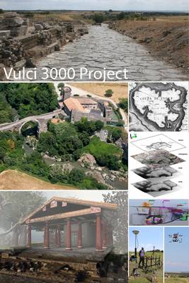
Vulci 3000 is a multidisciplinary project of archaeological research, training and digital communication focused on the Etruscan site of Vulci in central Italy. At many Etruscan sites archaeological research has focused on the necropoleis and funerary contexts. This research orientation has broadly led to a mystical image of Etruscan cities, primarily understood as “cities of dead” rather than living cities, complex settlements and social organisms. At Vulci, the Vulci 3000 Project will be pursuing an alternative line of research, focused on the organization of the ancient territory, population, and city plans – the living city. The research, to be carried out over five years will focus on the diachronic relationships between the ancient city and its landscape, and the organization of the urban center, will provide a different view of urbanism in central Italy, as Vulci emerges as a city is transformed through encounters with neighboring cultures and an expanding Roman state . Dr. Maurizio Forte and Dr. Nevio Danelon will collaborate with SPARC PIs to undertake topographic and architectural survey through terrestrial laserscanning, data that will aid in the contextualization and analysis of previously collected geophysical survey data, and form an integral part of the multi-source dataset supporting the project’s larger research agenda. The collaborative research project supported through SPARC will emphasize the analysis and interpretive characterization of the TLS data, pursuing innovative ways to use this type of data to support archaeological interpretation within an integrated multi-sensor dataset.
Archaeological data post-processing for Vulci is supported by the Bass connection grant (Duke University) and by the research team of the Dig@Lab and Media+Art and Sciences (Duke University). A new endowment for archaeological fieldwork recently established in the Department of Classical Studies (Duke) will partially support the project for the next three years.
- PIs: Dr. Maurizio Forte and Dr. Nevio Danelon
- Institutions: Duke University
- Project Type: Fieldwork
- Region: Mediterranean Europe
2015-02-23 05:21:23
PAST WORKSHOP: 3D imaging workshop February 2-4 at UNC Chapel Hill » By: Rachel Opitz
SPARC is supporting an intensive, hands-on three day workshop at UNC Chapel Hill, February 2-4, 2015. During this workshop participants will learn how to "capture" objects in 3D using Structure from Motion, edit the resulting models, and present them on the web. This workshop is primarily geared for archaeologists, but may be of interest to artists, museum professionals, geologists, and anyone interested in digital 3D technologies. For more information and to apply for a place in the free workshop, go to http://tinyurl.com/k4qoxcg.
2015-01-15 08:30:00
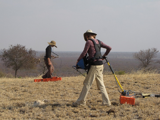
SPARC Webinar: Archaeological Geophysics - Sensor Selection and Site Suitability » By: Rachel Opitz
Speaker: Eileen Ernenwein (East Tennessee State University)
Archaeological geophysics includes the use of ground-penetrating radar (GPR), electromagnetic induction (EMI), electrical resistivity, and magnetometry to detect buried features. Many archaeologists are interested in using geophysics but are unsure if their site is suitable and which methods would be best. Is the site a good candidate for geophysical survey? Which methods should be used? How deep down can features be detected? How long will it take? This webinar presents background information on commonly used geophysical methods and a step-by-step approach to answering these and related questions.
Date: 17 October 2014
Time: 13:00 EDT
Place: http://tinyurl.com/psf3l44
How to Connect:
- 1. Go to: http://tinyurl.com/psf3l44
- 2. Enter your name when instructed and click ‘Log In’ to enter the meeting.
- 3. If this is the first time you are using Blackboard Collaborate you will be asked to download and run a small java program. Please allow a few minutes to connect if this is your first time using Blackboard Collaborate.
- PIs: Joseph Bagley and Jennifer Poulsen
- Institution: Boston Landmarks Commission
- Project Type: Anayltics
- Region: North America
- PI: Andrew Bauer
- Institution: University of Illinois
- Project Type: Fieldwork
- Region: India
- PI: Benjamin Porter
- Institution: University of California, Berkeley
- Project Type: Fieldwork
- Region: Near East
- PIs: Glenn Schwartz, Andrew Creekmore
- Institutions: Johns Hopkins, University of Northern Colorado
- Project Type: Fieldwork
- Region: Near East
- PI: Carla Klehm
- Institution: Washington University in St. Louis
- Co-PI: Eileen Ernenwein
- East Tennessee State University
- Project Type: Fieldwork
- Region: Africa
- PI: Orlando Cerasuolo, Erin Warford, Stephen Dyson
- Institution: SUNY Buffalo
- Co-PI: Orlando Cerasuolo, Erin Warford, Stephen Dyson
- Institution: SUNY Buffalo
- Project Type: Analytics
- Region: Mediterranean Europe
- PI: Krysta Ryzewski
- Institution: Wayne State University
- Co-PI: John Cherry
- Institution: Brown University
- Project Type: Analytics
- Region: Caribbean
- PI: Patrick Dolan
- Institution: Washington State University
- Co-PI: Colin Grier
- Institution: Washington State University
- Project Type: Fieldwork
- Region: North America
- PI: Kristin Safi
- Institution: Washington State University
- Project Type: Fieldwork
- Region: North America
- PI: Mehrnoush Soroush
- Institution: New York University
- Project Type: Analytics
- Region: Near East
- PI: Stacie King
- Institution: Glenn A. Black Laboratory for Archaeology, Indiana University
- Project Type: Analytics
- Region: North America
- Date: 29 January 2014
- Time: 14:00 CST
- Place: Webinar Meeting (Blackboard Collaborate)
- Speaker: Fred Limp (University Professor, Dept. of Geosciences, U. of Arkansas)
2014-10-06 15:27:25
Winter 2014 Funded Projects » By: Rachel Opitz
We are proud to announce the second group of projects supported by SPARC Awards. Congratulations to all the PIs.
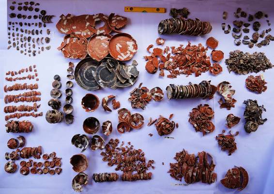
Identification of Coarse Earthenware Potters on Production and Consumption Sites in Charlestown, Massachusetts Using Fingerprint Biometric Identification
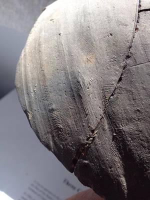
Joseph Bagley and Jennifer Poulsen of the Boston Landmarks Commission will be collaborating with SPARC researchers to use a structured light scanner to create detailed 3D models of ceramic artifacts featuring finger and hand prints from the Parker-Harris Pottery Site and Three Cranes tavern Site in Charlestown, Massachusetts. Fingerprints from redware vessels at both production and consumption sites will be analyzed. The goal of this proof-of-concept pilot project is to establish that biometric identifiers can be used to directly connect pottery from consumption sites with production sites when there is a known sale of product between production and consumption sites, tightly dated deposits that can limit association of pottery to specific potters, and there are a limited number of potters known to be producing these vessels. This project will also establish a visual reference collection of fingerprints with the potential for expansion into an automated fingerprint identification system of historic potters on both production and consumption sites in Charlestown and beyond. This type of database could establish previously-unknown associations and commercial networks of domestic redware potters across the eastern United States. With data as unique and personal as a fingerprint, the results of this analysis with bring a personal and evocative light to these significant assemblages, allowing the public to appreciate these forgotten and sometimes nameless potters through the intimate association of their hands.
Biodiversity as a Social Process: Land Use, Resource Consumption, and Near-surface Geophysical Explorations at South Indian Iron Age-Early Historic Settlements
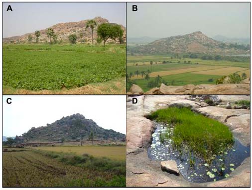
Dr. Andrew Bauer of the University of Illinois will be collaborating with SPARC researchers to carry out near-surface mapping of magnetic anomalies as part of a broader interdisciplinary project designed to examine the related social and natural histories of the understudied inselbergs (island mountains) of the peninsular interior of South India. This research will improve our understanding of the development of social distinctions in ancient South India and to establish the inselbergs' ecological histories.
The planned geophysical explorations have the strong potential to identify structures and activity spaces for forthcoming excavations of habitation and metals production locales at two sites of this type, Kadebakele and Maski, where artifact surface distributions and early textual sources suggest specialized extraction and production of iron and gold occurred. Identifying the location of metalworking facilities at Early Historic Kadebakele through the geophysical survey would enable an evaluation of the scale and degree of metallurgical production within a settlement context. Reliance upon iron blooms smelted 20 km. from the settlement would have had both profound implications for the regional political economy as well as the ecology of the adjacent inselberg hills, where fuel demands for smelting vs. smithing would have had vastly different implications for plant and animal communities, soil erosion, and additional human land-use practices. At Maski the geophysical survey will enable us to identify important temporal shifts in production and the degree to which manufacturing activities were socially specialized, centralized, or more evenly distributed among ancient inhabitants, and likewise the degree to which production and consumption of certain materials and artifact forms contributed to the creation and maintenance of social distinctions. Furthermore, the intensity of production activities and careful documentation of fuel usage in various stages of metallurgical production at Maski will allow us to link production activities with the results of ongoing stratigraphic paleoecological assessments of the hill's vegetation history. Overall, the geophysical research will provide a critical bridge between pedestrian survey and paleoecological sampling analyses and the excavation of subsurface contexts where sociocultural production and consumption activities can be evaluated.
Measuring Household Economies in Iron Age Southwest Jordan: An Archaeological Case Study from Edomite Busayra
Anthropological archaeologists have long sought to document and explain how the economies of past societies responded to imperial rule. Scholars have paid particular attention to the ways indigenous economies reacted under the stress of imperial demands for tribute and market demands for new or more products. Producers, either on their own or with assistance from imperial sponsorship, could intensify the organization of their economies in order to increase output and meet these new demands. This project investigates questions of how producers in semi-arid zones create sustainable economies that meet their precarious subsistence requirements while achieving the demands of empires and new markets. In this project Dr. Porter will collaborate with SPARC researchers to carry out geophysical survey at Busayra to map sub-surface features in order to characterize the overall architectural layout of the settlement as well as identify domestic residences for additional sampling. The results of the geophysical survey will help target excavation, which in turn will concentrate on recovering inorganic and organic evidence from secure contexts in order to answer the project's principal research question concerning how household economies were reorganized, elucidating evidence for trends toward economic specialization to maximize output in a semi-arid environment.
This research is supported by the Jordanian Department of Antiquities al-Hima (http://www.alhima-jo.org/en), American Center of Oriental Research (ACOR) in 'Amman, the University of California, Berkeley, and the University of California, Berkeley's Archaeological Research Facility.
2014-08-24 13:30:45
SPARC supports The Kurd Qaburstan Project » By: Rachel Opitz
Drs. Creekmore and Schwartz are using geophysics and remote sensing to investigate the spatial distribution of architecture and infrastructure at Kurd Qaburstan, a 118 hectare second millennium BC urban center located outside Erbil, Northern Iraq. SPARC is supporting this work through the collection of aerial photography in order to create microtopographic maps to overlay with other datasets. With this data we are testing the hypothesis that despite having city walls enclosing areas comparable in size to Early Bronze Age (EBA) cities, Middle Bronze Age (MBA) cities were hollow, containing relatively small built-up areas alongside large areas of unbuilt space. This model has been suggested by scholars on the basis of excavations at various sites and interpretations of CORONA imagery at Kurd Qaburstan that identify large empty areas and relatively small built-up areas. If this hypothesis is supported it indicates that there were significant socio-political, economic, and demographic differences between the EBA and MBA city-states in Upper Mesopotamia. If this hypothesis is not supported then we should revise our interpretations of CORONA imagery at Kurd Qaburstan and other sites across Mesopotamia, and rethink the structure of MBA cities.
The Kurd Qaburstan Project is supported by the National Science Foundation (BCS-1156171), the National Geographic Society (9496-14), Johns Hopkins University, and the University of Northern Colorado.
2014-07-12 06:15:10
Spring 2014 Funded Projects » By: Rachel Opitz
We are proud to announce the first group of projects supported by SPARC Awards. Congratulations to all the PIs.
Spring 2014 Projects
Bosutswe Landscapes: Exploring early African towns through geophysics and photogrammetry
Drs. Klehm and Ernenwien will be using geophysical and airborne thermographic survey to study three small rural sites in Botswana, with the aim of expanding our understanding of the local social, political, and economic landscape around the polity site of Bosutswe, the central site for this area. Low-altitude aerial remote
sensing of the hilltop site of Mmadipudi Hill, two small grounds sites (Queen’s Site and Queen’s House Site) is planned to try and detect subsurface features at known sites and identify new, unknown sites. This work will be complemented by on-the-ground geophysical methods (EMI, magnetometry, and GPR) to characterize the subsurface at known and newly discovered sites in order to understand their spatial layout. The end products from the geophysical and aerial remote sensing surveys will be integrated to understand intra-site spatial patterns and spatial relationships between sites in the region.
Etruria Before and After the Roman Conquest. The Landscape of Vulci.
Over a thousand archaeological sites have been identified in the landscape around Vulci, located north of Rome in Italy through a variety of surveys and excavations. Through this SPARC supported project, researchers from SUNY Buffalo and Accademia Nazionale dei Lincei - Rome will be bringing this information, together with environmental and topographic data and aerial imagery, to bear in a new study of the territory, aiming to better understand the military, social, and economic organization of the pre-Roman landscape, and the Etruscan response to Roman invasion— a critical period currently understood mainly from a Roman perspectives— and the Roman changes to the territory after the conquest of Vulci. Integrating and analyzing these complex data, the project will investigate questions of continuity and change, the organization of the local rural economy, the influence of the natural environment, and the value of a landscape approach to the study of the region's social structures.
This research project is conducted with the kind cooperation of the Soprintendenza per i Beni Archeologici dell'Etruria Meridionale, the Soprintendenza per i Beni Archeologici della Toscana and the Riserva Naturale Selva del Lamone.
Lidar data acquisition and landscape archaeology for the Caribbean island of Montserrat
The Survey and Landscape Archaeology on Montserrat project began in 2010, and Drs. Ryzewski and Cherry have been conducting pedestrian survey for four field seasons. The dense vegetation and steep terrain of this island preclude intensive, systematic survey and ground visibility is extremely poor - even standing remains are often hidden by dense tropical forest vegetation. Through their SPARC project, they will begin to use airborne lidar data to map potential cultural landscape features and other anomalies in the Centre Hills region of the island and guide future prospection strategies. This work will generate essential diachronic data and provide the foundations for research on broader questions of long term land-use, settlement history, strategies for risk management, and consequences of migrations and colonization, enabling the researchers to develop new insights into Montserrat’s past inhabitants and relationships with the wider Caribbean region.
This research is conducted with the kind collaboration of the Montserrat Volcano Observatory and Montserrat National Trust.
The economic organization of a pre-contact Northwest Coast village
Patrick Dolan and Colin Grier will be using magnetometry survey to collect essential data on the organization of domestic space and households at the Dionisio Point Site in the Gulf Islands, British Columbia. This data will be used to support the broader study of economic indicators of household food production and consumption at a single plank house village in southwestern British Columbia. The SPARC supported phase of the project will generate baseline architectural and demographic data for this village by identifying hearths and other basic household features, part of a growing number of projects using geophysical research to investigate small-scale hunter-fisher-gatherer village economies and the development of social complexity.
This research is generously supported by NSF Grant No. 1062615 and an NSF-Doctoral Dissertation Research Improvement Grant No. 1342025
Evaluating Competition Beween Chaco-Style Great Houses in the Southern Cibola Region of West-Central New Mexico
Kristin Safi's project aims to investigate the social mechanisms operating within great house community organization and inter-community interaction that served to integrate and differentiate multi-ethnic communities in the southern Cibola region of west central New Mexico. With SPARC support, she will collect geophysical and airborne thermographic survey data to identify key structures and better understand the organization of the Largo Gap great house. This data will help address the extent to which local great houses in the southern Cibola region maintain a suite of “Chaco” characteristics, or incorporate both Puebloan and Mogollon architectural conventions as a reflection of its multi-ethnic community constituents, with broader implications for our understanding of Chacoan great house communities in the American Southwest and the role of local, inter-community competition in structuring group formation and the negotiation of group identity within the increasingly heterogeneous social landscape of this region during the 11th century.
The Largo Gap Community Project is supported by the National Science Foundation through a Doctoral Dissertation Research Improvement Grant (#1340542), the National Geographic Society (Grant #9323-13), and a research grant by the Arizona Archaeological and Historical Society.
Modeling Long-Term Water Management Strategies on the Irrigated Plain of Miān-āb, in the Khuzistan Province of Iran. Type of Application:
Mehrnoush Soroush's project attempts to understand the longue durée water management strategies on the irrigated landscape of Miān-āb, in the Khuzistan Province of Iran. Using historical aerial photographs and declassified Corona imagery she plans to create a historical DEM and carry out hydrology modeling to study the workings of a complicated irrigation system, which includes canals, dams, weirs, bridges, subterranean channels, and earthen enclosures, that extend over 4000 km2. The project aims to shed light on the dynamics of decision-making and community practices for the management of water resources of Miān-āb from antiquity until the onset of modern agricultural development. New insights into past irrigation and water management derived from this study have the potential to contribute to a more informed and sustainable strategy for the future of the landscape in Miān-āb.
A 3D Digital Collection and Virtual Exhibit for Santa Ana Tavela's Community Museum
Stacie King will be developing a workflow and protocol to model and virtually display objects from a community museum collection in Santa Ana Tavela, Mexico, using structure from motion style photogrammetry and an open source, lightweight approach to virtual museums. This project aims to bring information about the collection to a wider audience and provide the local community with a stake in presentation and interpretation of their heritage, while fulfilling national requirements regarding stewardship of archaeological materials. The project explores issues of how well digital media enhances and democratizes access to physical artifact collections and serves as a means of digital repatriation.
2014-02-15 20:04:28
Past SPARC Webinar: From photos to models. Strategies for using digital photogrammetry in your project » By: Rachel Opitz
Adam Barnes and Katie Simon spoke at 11:00 CST on the 26th February 2014, providing detailed and practical information on using photogrammetric modeling in archaeology. Photogrammetry has rapidly gained popularity in archaeology as a quick, easy, and low-cost method for creating 3D models of objects, structures, sites, and landscapes. The combined effect of relatively low-cost hardware and software, increased computing power, and greater ease of data collection requirements make the method a very attractive option. So is close-range/structure from motion photogrammetry the right solution for your needs? This webinar serves to provide the basic knowledge needed to answer this question, including details on data capture and processing, product generation, and dissemination. The pros and cons of close-range photogrammetry will be discussed for a variety of project types, as well as recommendations for creating the most accurate and useful models for your applications. Analysis including documentation, 3D spatial analysis, change detection, classification, and site and feature prospecting will be covered. Enhanced presentation with additional materials and recordings coming soon!
2014-02-03 14:16:45
Past Webinar: Multi-Scalar 3D Documentation » By: Christopher Angel
29 January 2014 - Slides and recordings are now online on the webinar page, under the "Spring 2014 Webinar Series" tab. Abstract: There are currently a number of technologies that provide for the detailed 3D documentation of archaeological objects, features, sites and landscapes. We use the phrase “high density survey and measurement” (or HDSM) as a container for all of these. HSDM includes “laser” scanning – a term which refers to aerial systems using pulsed lasers (often called LiDAR) and terrestrial systems using pulsed time-of-flight and phase-shift laser scanners, structured light scanners, and other technologies. HSDM also includes aerial systems using photogrammetric methods and terrestrial systems using what has been termed “close range photogrammetry” or “structure from motion”. Each of these methods independently provides many valuable sources of data for archaeologists and heritage professionals. They become even more powerful when seen as an integrated set of methods – however – each has its own data structures and practices. Integrating these has a number of technological challenges but when accomplished yields significant rewards. Of particular note is that the use of the suite in an integrated manner allows the multi-scalar study of the past, providing rich contextualization at all levels.
2014-01-13 13:19:05
|
|
|
|
|