What is SPARC?
SPARC is an NSF-funded archaeology and archaeometry program dedicated to promoting geospatial research in archaeology. SPARC pairs archaeologists with geospatial experts from University of Arkansas’s Center for Advanced Spatial Technologies (CAST) and Dartmouth’s Spatial Archaeometry Lab (SPARCL) through:
- Supported Research Projects, which are our flagship peer-reviewed, in-kind awards that provide SPARC-funded staff time, equipment use, and travel to assist with pilot projects;
- Research Collaborations, which include consultations, small projects (less than 20hrs staff time), or projects with significant cost-share by the external collaborator; and
- Residencies which provide stipends of $1000 to travel to CAST or SPARCL to undergo face-to-face collaborations, utilize equipment and facilities, and develop publications.
Based on focus, these projects are classified in one of the following categories:
Research outcomes associated with SPARC project include publications, presentations, new grants, and websites, as well as the archiving of geospatial research. In addition, you can learn about the latest technologies and their archaeological applications through our online resources (including our new GitHub teaching exercises) and periodic webinars.
General resources about spatial archaeometric applications for archaeology and specifics about the residency program, can be found under the Learn section. Researchers interested in supported research projects should explore the Develop and the appropriate Apply sections (e.g., for fieldwork, data and analytics, or publications proposals). You can also contact us directly a sparc@cast.uark.edu to develop projects in partnership with SPARC, for advice of research proposals, or for other consultations.
Recent News
Teaching Resource: Reuse of archived digital 3D models for university students: ( 11/02/20) The SPARC Program supports good practice in archiving of our projects in Zenodo (see "Consult Standa... More Info
What happens after a SPARC Project is completed? Research Outcomes, Finals Reports, and Archiving: ( 09/02/20) SPARC follows the best practices in digital archaeology by making our results publicly accessible to... More Info
Publication Highlight: Least-cost path and viewshed analyses to model territorial boundaries: ( 09/02/20) SPARC PI Nicholas Carter and colleagues published their article, “Country roads: Travel, visibilit... More Info
We are currently accepting applications for the 2021-2022 SPARC Program on a rolling basis.
We are especially interested in projects that overlap with our 2020-20201 Analytical Development Priorities, which include:
- Historic aerial and satellite imagery analysis
- SPARC examples: Namonte (Davis), Bosutswe (Klehm), Chacoan Monuments (Dungan)
- Additional example: CORONA Atlas (https://corona.cast.uark.edu/)
- sUAS ("drone") based sensors (e.g. LiDAR, thermal, SWIR, multi- and hyper-spectral)
- SPARC examples: Cedar Mesa (Lipe), Hawai'i (McCoy), Midewin (McLeester)
- MicroCT applications
- SPARC example: All That Glitters (de Luna)
- Additional examples: https://archeology.uark.edu/learn-discover/current-research/micro-ct/, applications for bioarchaeology and paleopathology, ceramics, organic materials, or novel material types
- Data analytics, data science
- SPARC examples: Five Lands (Carter), GeoPACHA (Wernke)
- Additional examples: image matching, feature recognition, data mining, use of high-performance computing, APIs
- Digital data management
- SPARC example: Marzuolo (Vennarucci)
- Additional examples: planning workflows (e.g., for equipment or software use, project design), digital recording systems, interfaces
- Visualization and archiving of complex spatial datasets
We also encourage inquiries about proposal development for collaborations beyond the scope of the SPARC Program.
References
Hassett, B.R. (2018) Which Bone to Pick: Creation, Curation, and Dissemination of Online 3D Digital Bioarchaeological Data. Arch 14, 231–249. https://doi.org/10.1007/s11759-018-9344-z
Opitz, R. (2017) An experiment in using visual attention metrics to think about experience and design choices in past places. Journal of Archaeological Method and Theory, 24(4), pp. 1203-1226. https://doi:10.1007/s10816-016-9310-2
Tuniz C., Zanini F. (2018) Microcomputerized Tomography (MicroCT) in Archaeology. In: Smith C. (eds) Encyclopedia of Global Archaeology. Springer, Cham. https://doi.org/10.1007/978-3-319-51726-1_675-2
What is Spatial Archaeometry?
Spatial Archaeometry is the application of scientific techniques to measure properties of archaeological materials at all scales, including objects, sites and landscapes, wherein the spatial properties of the measurements are central to their analysis and interpretation.
What we do.
We help you learn about spatial archaeometry, develop your ideas through collaborative project proposal writing, apply your research plans through SPARC research support awards, and collaborate your results and experience with the archaeological community.
Why we do it.
Collaborating on research, sharing equipment and resources, and facilitating knowledge exchanges and best practices will promote the use of remote sensing methods and geospatial in archaeological research and assist researchers in meeting their project's goals.
SPARC Areas of Expertise
Funded Projects » See All Funded Projects
A 3D Digital Collection and Virtual Exhibit for Santa Ana Tavela's Community Museum
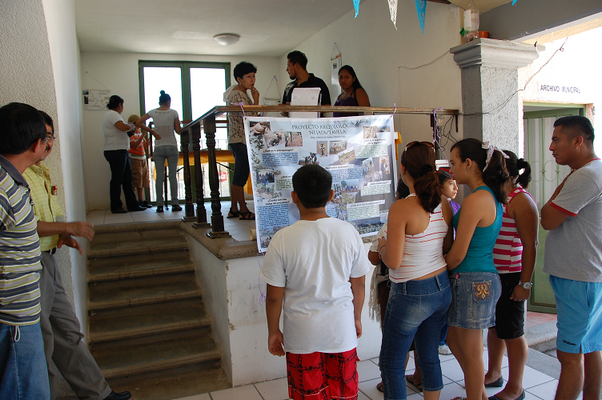
Stacie King will be developing a workflow and protocol to model and virtually display objects from a community museum collectio... More Info
Locating the Oneota Landscape at Midewin National Tallgrass Prairie
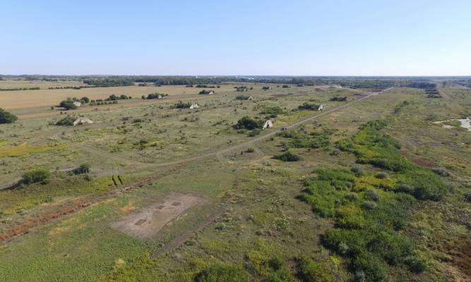
Since 2016, Dr. Madeleine McLeester and her colleagues have been excavating at a 17th century Native American village located at t... More Info
Important Dates
|
|
|
|
|