About » Funded Projects
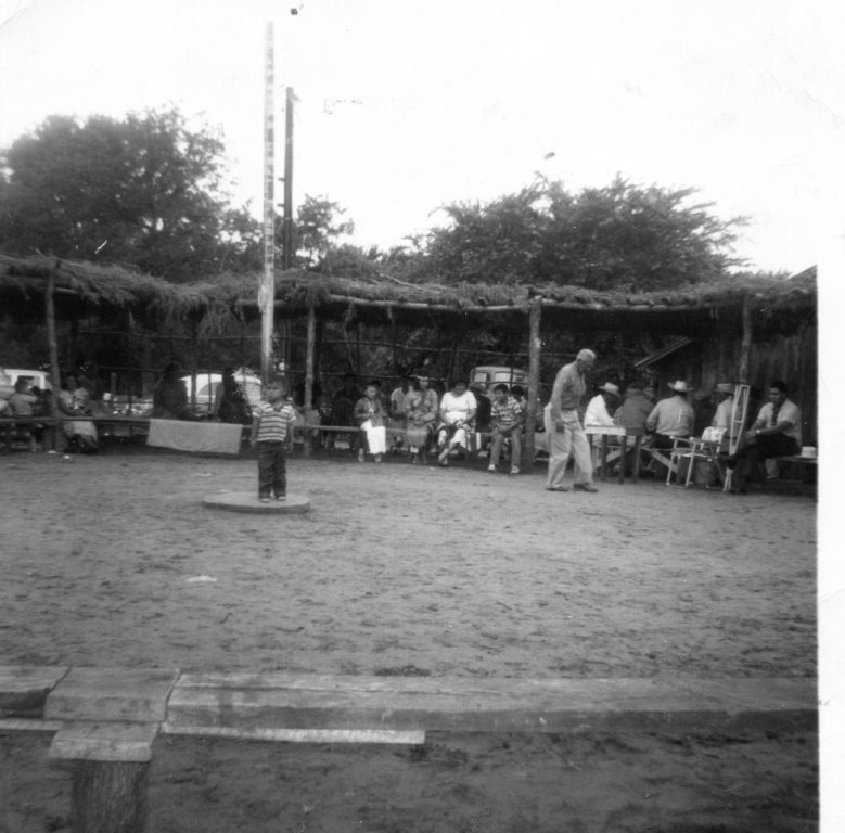
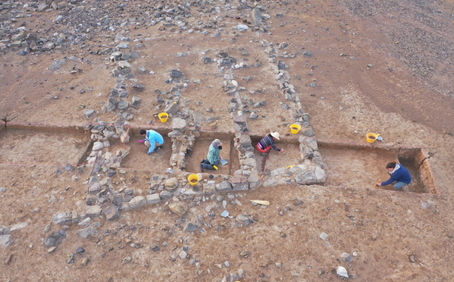
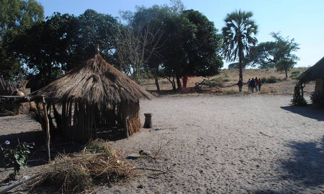
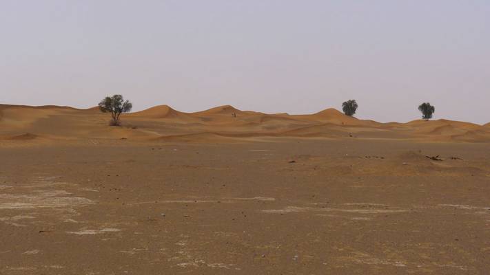
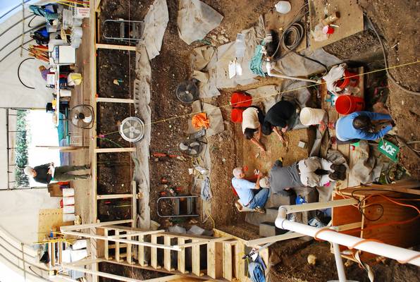
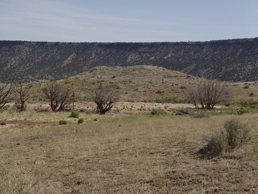
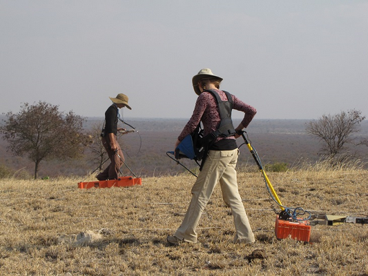
Remembering ichaskhah (Camp Creek)
This project is part of a larger research program aimed at understanding the complex occupational histories of lands allotted to Native Americans after 1887. Despite U.S. Federal efforts to destroy their culture, the Wichita and Affiliated Tribes persisted, continuing their practices of camping, bui... More Info
- PI: Brandi Bethke
- Institution: Oklahoma Archaeological Survey
- Co-PI: Sarah Trabert; Scott Hammerstedt; Gary McAdams
- Instituion: University of OK; OK Archaeological Survey; Wichita & Affiliated Tribes
- Region: North America (Southern Great Plains)
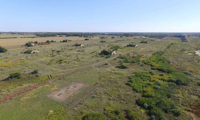
UAV LiDAR Collection to Model Contemporary Erosion and Landform Change on the Pinson Landscape, TN, USA
Pinson Mounds State Archaeological Park (PMSAP) in West Tennessee, USA maintains the largest archaeological site constructed by Middle Woodland societies (ca. 200 BCE – 500 CE) in the American Southeast. However, the broader Pinson Landscape includes associated sites (e.g., Johnston and Elijah Bra... More Info
- PI: Edward Henry
- Institution: Colorado State University; Center for Research in Archaeogeophysics and Geoarchaeology
- Region: North America (American Southeast)
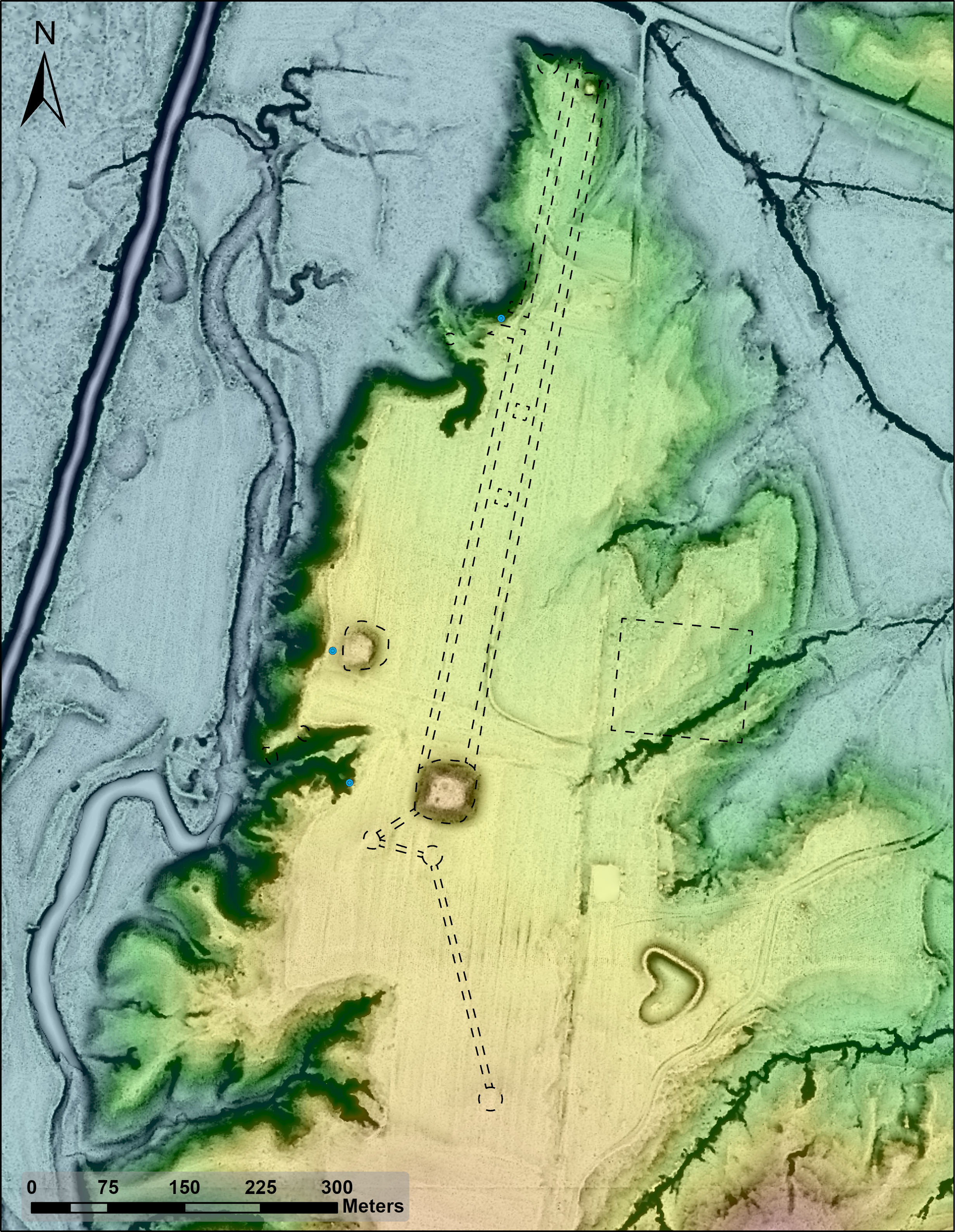
Sinop Regional Archaeological Project
SRAP is a regional transdisciplinary program that is investigating the evolving relationship between one of the most important ports in the Black Sea region and its surrounding hinterland from the Early Bronze Age (ca. 2300 BCE) through Ottoman times (early 20th c. CE), itself the pivot of Eurasian... More Info
- PI: Dr. Owen Doonan
- Institution: California State University Northridge
- Co-PI: Dr. Andrew Goldman, Dr. Jane Rempel, Dr. Alexander Bauer, Berk Suleyman,
- Instituion: Gonzaga University, University of Sheffield, Queen College CUNY, Istanbul T
- Region: Near East
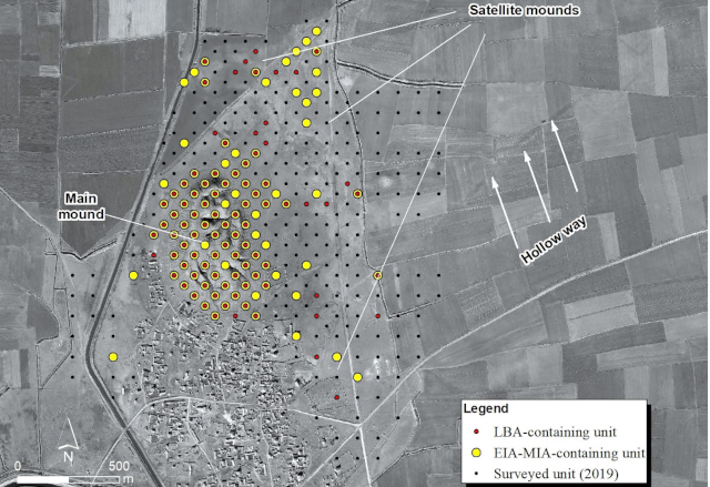
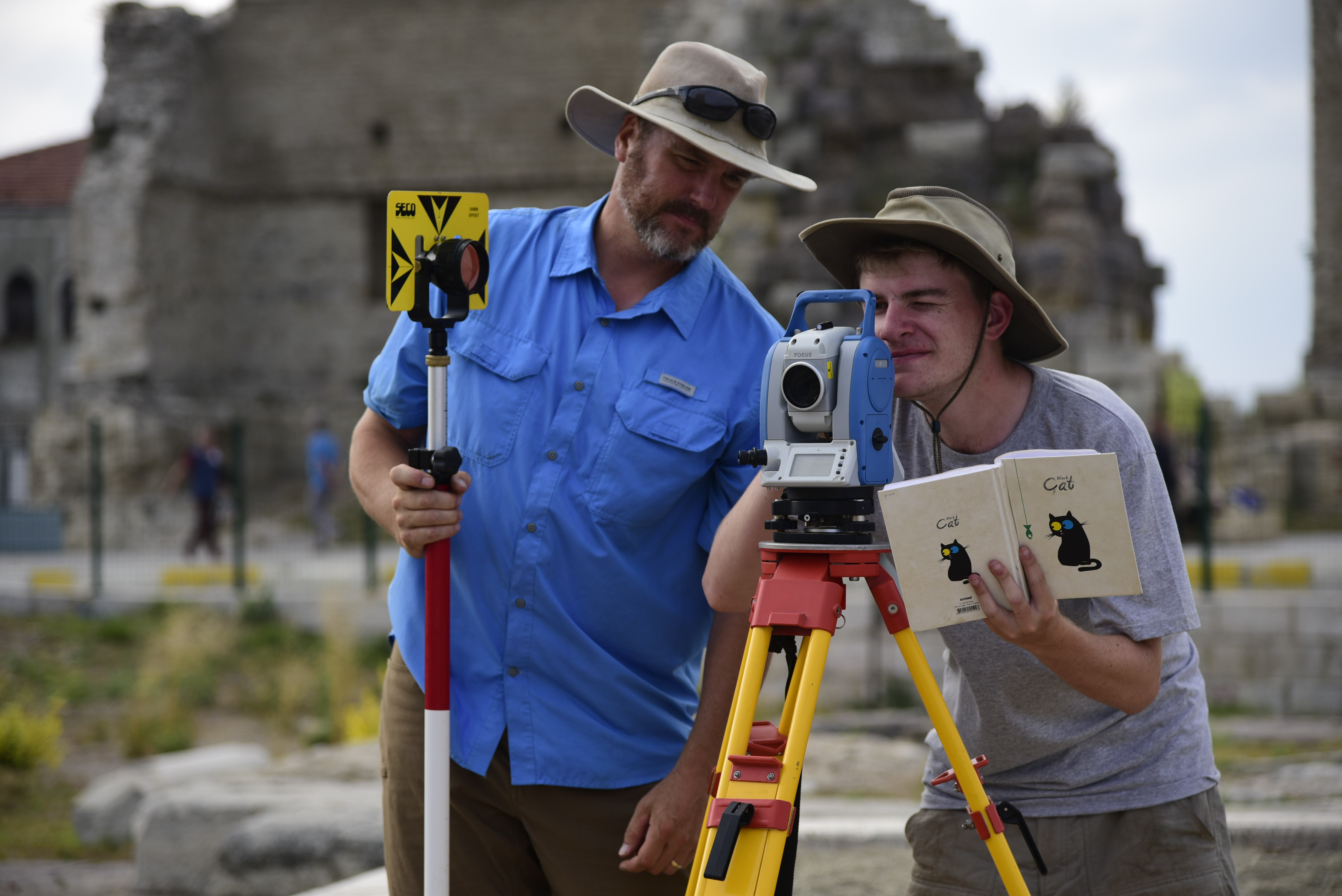
The Türkmen-Karahöyük Intensive Survey Project/Konya Regional Archaeological Survey Project: Urbanism and Political Complexity in South-Central Turkey
The Konya Regional Archaeological Survey Project has for several years been identifying ancient settlements and landscape features of all periods in Turkey’s archaeologically rich Konya Plain, famous especially for its Neolithic occupation and sites such as Çatalhöyük. Far less understood, howe... More Info
- PI: Anthony Lauricella
- Institution: University of Chicago, Oriental Institute
- Co-PI: Michele Massa; James Osborne
- Instituion: University of Chicago, Oriental Institute
- Region: Near East
Beyond the Oasis: The Ancient Cultural Landscape of Bat and the Sharsah Valley
The Bat Archaeological Project is beginning a new phase of research on the Umm an-Nar period (ca. 2800-2000 BCE) cultural landscape of the UNESCO World Heritage Site of Bat and its surroundings in the Sharsah Valley of northwestern Oman. The 4 square kilometers oasis site of Bat includes an array of... More Info
- PI: Jennifer Swerida
- Institution: Penn Museum, University of Pennsylvania
- Co-PI: Eli Dollarhide
- Instituion: New York University Abu Dhabi
- Region: Near East
Remote Sensing at Picuris Pueblo, New Mexico
The primary goal of the Picuris Collaborative Archaeology Project is to collect archaeological data that will directly address questions around past land use practices and exchange relationships among the people of Picuris Pueblo, located in northern New Mexico. Since the 10th century CE, Picuris ha... More Info
- PI: Michael Adler
- Institution: Southern Methodist University
- Co-PI: Severin Fowles; Lindsay Montgomery
- Instituion: Barnard College Columbia University; University of Arizona
- Region: North America
Testing Imperial Development on the Erbil Plain in the Kurdistan Region of Iraq
The Erbil Plain Archaeological Survey (EPAS) has investigated the long-term landscape of the Erbil Plain in Iraqi Kurdistan since 2012. The project, co-directed by Jason Ur (Harvard University) and Nader Babakr (Erbil Directorate of Antiquities, Kurdistan Regional Government), has focused on the se... More Info
- PI: Jason Ur
- Institution: Harvard University
- Region: Near East
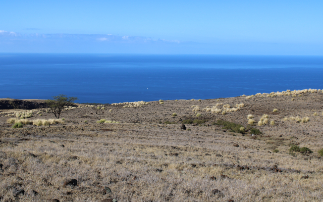
Application of Remote Sensing to the South Kohala Field System, Hawaiʻi Island
This project will investigate the ancient agricultural fields of the South Kohala Field System in the leeward (dry) uplands of South Kohala, Hawai‘i Island. A large portion of these fields do not overlap with the hypothesized ideal area for rainfed agriculture in Hawaiʻi, suggesting that Native H... More Info
- PI: Michael Graves
- Institution: University of New Mexico
- Co-PI: Katherine Peck
- Instituion: University of New Mexico
- Region: Pacific Islands
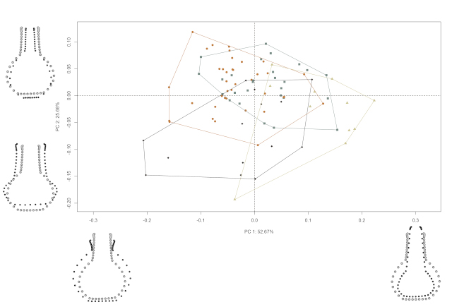
3D Scanning and Morphometrics
This effort follows a recent social network analysis in which two Caddo landscapes of practice (north/south) were identified. Each landscape was further scrutinized, resulting in the identification of constituent communities based upon the co-presence of specific suites of Caddo material culture (di... More Info
- PI: Robert Selden
- Institution: Stephen F. Austin State University
- Region: North America
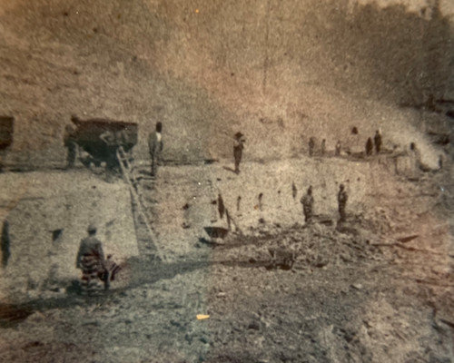
Identifying Structures related to Postbellum Industrial Convict Leasing in Southern Middle Tennessee
Dr. Westmont and members from the SPARC team will collect drone-based LiDAR and thermal imaging remote sensing of the Grundy Lakes Valley, the site of a postbellum nineteenth century coal mining and coke producing industrial operation relied upon forced prison laborers, the majority of whom were Afr... More Info
- PI: Camille Westmont
- Institution: The University of the South
- Region: North America
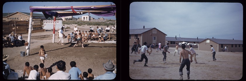
Digital Storytelling: The Landscape of Sport at the Granada Japanese American Relocation Center
The University of Denver’s (DU) community-based research at Amache, the site of a World War II Japanese American incarceration camp in Colorado, has produced a rich collection of archaeological data from survey and excavations over the course of six field seasons. These powerfully combine with ora... More Info
- PI: April Kamp-Whittaker
- Institution: University of New Mexico
- Co-PI: Bonnie Clark
- Instituion: University of Denver
- Region: North America
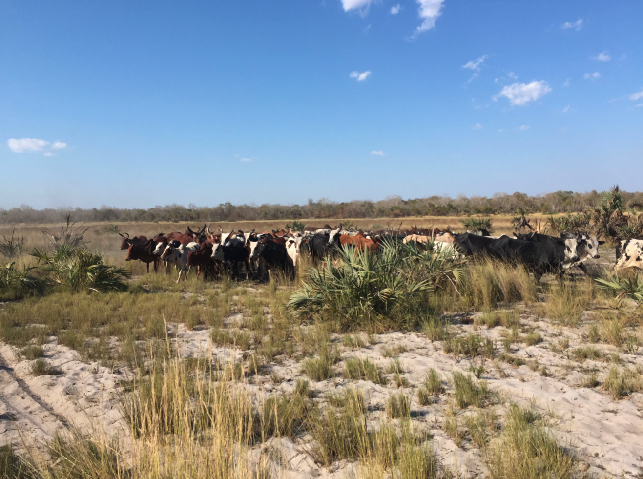
Quantifying pastoralist niche construction on southwest Madagascar using multi-sensor remote sensing (1600 – Present)
This project will focus on the analysis of satellite imagery from the Namonte region of southwest Madagascar to clarify the interplay between pastoralist activities and environmental change over the past 400 years. This research addresses a critical need to understand how local people in SW Madagasc... More Info
- PI: Dylan Davis
- Institution: The Pennsylvania State University
- Co-PI: Kristina Douglass
- Instituion: The Pennsylvania State University
- Region: Africa
All that Glitters: Spatial Archaeometric Approaches to Specularity
This pilot ceramic analysis is part of a larger project using archaeological and linguistic evidence to reconstruct the history of pyrotechnologies across five millennia in south central Africa to understand the coproduction and politicization of emotions, senses, and materials’ technological unde... More Info
- PI: Kathryn de Luna
- Institution: Georgetown University
- Region: Africa
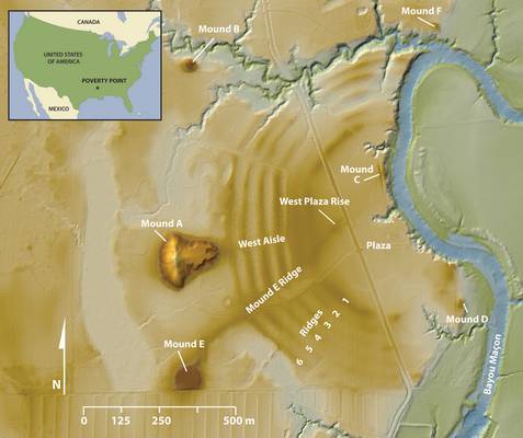
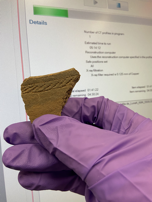
3D GPR Survey at the Poverty Point World Heritage Site
Ultra-high resolution 3D ground penetrating radar (GPR) technology will be used in a test application at the Poverty Point World Heritage Site (WHS). Located in northeastern Louisiana, the site consists of a vast, integrated complex of earthen monuments, constructed 3,700-3,100 years ago by hunter-f... More Info
- PI: Rinita Dalan
- Institution: Minnesota State University Moorhead
- Co-PI: Diana Greenlee; Arne Anderson Stamnes
- Instituion: University of Louisiana Monroe; NTNU University Museum (Norway)
- Region: North America
2019
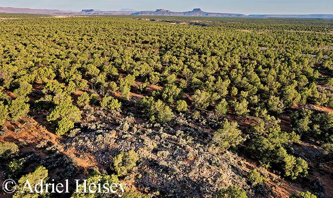
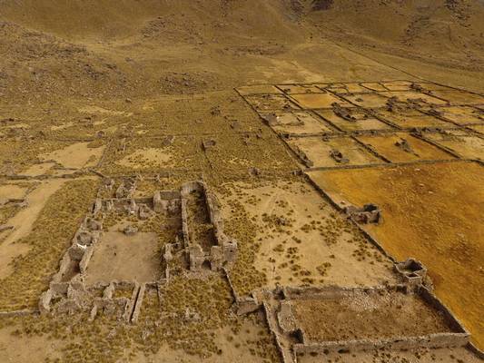
Mapping Chacoan Roads in SE Utah Woodlands
A team of archaeologists and SPARC researchers will use drone-based sensors to map roads dating to the A.D.1100s and 1200s in the Cedar Mesa area of southeastern Utah. Such roads are thought to represent extension of a regional socio-religious network centered at Chaco Canyon in New Mexico over 250 ... More Info
- PI: William Lipe
- Institution: Washington State University
- Co-PI: R. G. Matson; Winston Hurst; Jonathan Till
- Instituion: University of British Columbia; Independent; Edge of the Cedars SP Museum
- Region: North America
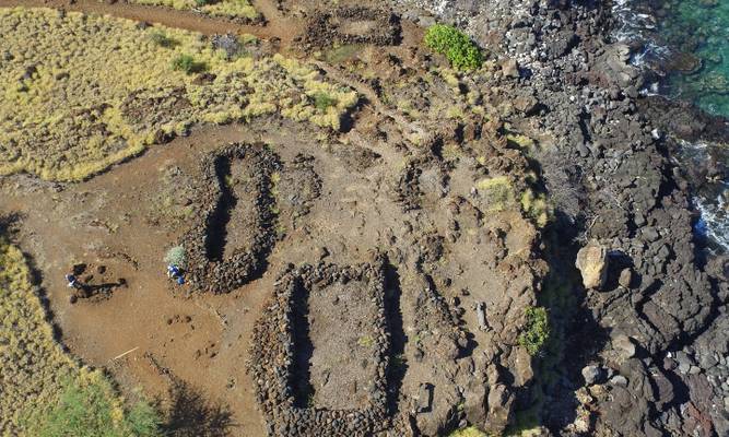
Measuring the Influence of Royal Centers in the Early States of Ancient Hawaii
Together with SPARC researchers, Drs. McCoy and Ladefoged, and Mr. Johnson, will use UAV-based LiDAR to map settlements along the coast of Hawaiʻi Island. Working with local Native Hawaiian (Kānaka Maoli) stewards, and the State Parks of Hawaiʻi, the team will examine what influence royal centers... More Info
- PI: Mark McCoy
- Institution: Southern Methodist University
- Co-PI: Thegn N. Ladefoged; Adam M. Johnson
- Instituion: University of Auckland; Southern Methodist University
- Region: Oceania
Geophysical investigations of 9th- to 14th-century AD occupation mounds in the Basanga Region of western Zambia: Research at Mwanamaimpa
This project will use a range of geophysical survey tools to explore a settlement mound in the Kafue River floodplain of south central Africa in Zambia. These mounds were occupied continuously from the late first to second millennium AD, with domestic and other debris accounting for more than five m... More Info
- PI: Jeffrey Fleisher
- Institution: Rice University
- Co-PI: Matthew Pawlowicz; Kathryn de Luna
- Instituion: Virginia Commonwealth University; Georgetown University
- Region: Africa
Locating the Oneota Landscape at Midewin National Tallgrass Prairie
Since 2016, Dr. Madeleine McLeester and her colleagues have been excavating at a 17th century Native American village located at the former Joliet arsenal, Midewin National Tallgrass Prairie, in northern Illinois. The site is currently defined by a series of subterranean storage features; however, ... More Info
- PI: Madeleine McLeester
- Institution: University of Notre Dame
- Region: North America
Ancestral Pueblo Occupation on the Mesa Verde North Escarpment
(Image credit: Sean Field) Dr. Reese and SPARC collaborators will use UAV-based LiDAR and thermal imaging data collection to help document the extent of Ancestral Pueblo occupation and use of the Mesa Verde North Escarpment from A.D. 600–1300. The data will be used to create a detailed bare earth ... More Info
- PI: Kelsey Reese
- Institution: University of Notre Dame
- Region: North America
2018
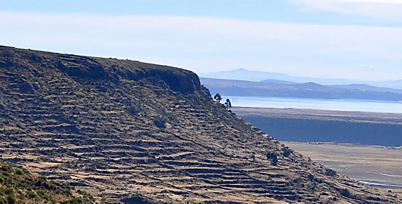
The Altiplano Agriculture and Communities Project
Dr. Brieanna Langlie is collaborating with the SPARC team to map and study past and present-day agricultural terraces in the Lake Titicaca Basin. This extensive landscape study is essential to Dr. Langlie's archaeological and ethnobotanical project in the to examine the past, present, and future of... More Info
- PI: BrieAnna Langlie
- Institution: Binghamton University
- Region: South America
2017
Developing GeoPACHA: Geospatial Platform for Andean Culture, History, and Archaeology
This project will contribute to the development of GeoPACHA (Geospatial Platform for Andean Colonial History and Archaeology), a geospatial database and interface for producing thematic and analytical maps, currently being created by the PIs with support of the NEH (award #HD-229071-15) and Mellon F... More Info
- PI: Steven Wernke
- Institution: Vanderbilt University
- Co-PI: Nathaniel (Parker) VanValkenburgh
- Instituion: Brown University
- Region: South America
Bosutswe Landscapes Regional Survey: Building a Predictive GIS Model of Archaeological Sites in the African Interior
(Image credit: Mica Jones) The Bosutswe Landscapes Regional Survey (BosLand) began in 2014 to works towards a better understanding of the precolonial cities and kingdoms that arise in the African interior around the 1st millennium AD. This project focuses on building a GIS to integrate extensive, ... More Info
- PI: Carla Klehm
- Institution: Washington University in St. Louis
- Region: Africa
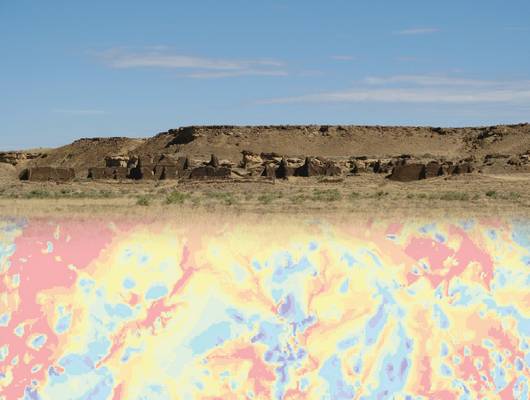
Using Total Viewsheds to Evaluate Visibility in the Placement of Chacoan Monumental Architecture
This project seeks to answer a series of questions related to the visual environment of Chacoan monumental architecture. The projects key questions are: 1) To what extent were great houses and other Chacoan structures positioned to maximize their visibility within local landscapes? 2) Did the choice... More Info
- PI: Katherine Dungan
- Institution: Archaeology Southwest
- Co-PI: Sylviane Déderix and Kristin Safi
- Instituion: University of Arizona and Oak Ridge National Lab
- Region: North America
Stagville Landscapes via LiDAR
The Stagville Landscapes project will examine the nearly 20,000 acres of plantation lands owned by the Cameron family of North Carolina from 1776 through the middle of the 20th century. The project represents an important opportunity to examine a single plantation complex in its entirety. The resu... More Info
- PI: Anna Agbe-Davies
- Institution: University of North Carolina, Chapel Hill
- Region: North America
2016
Mapping the Iron Age Metalworking Site of As-Safah (Oman)
This project will use Ground Penetrating Radar (GPR) to transform understanding of Iron Age metallurgy in Oman, looking specifically at the metalworking site of As-Safah – located at the edge of the Rub’ Al-Khali (Empty Quarter) of Arabia. The geophysical investigations will address question... More Info
- PI: Michael Harrower
- Institution: John Hopkins University
- Co-PI: Frances Wiig and Ioana Dumitru
- Instituion:
- Region: Near East
Architectural Sequences in the Shire Region
Together with SPARC researchers, Drs. Wendrich and Barnard and Ms. Moy will undertake geophysical survey and analysis of archaeological remains dating to the Aksumite Period across an occupation area around the sites of Mai Adrasha and Mezebar Adimenabr (Ethiopia). The material culture of this perio... More Info
- PI: Willeke Wendrich
- Institution: University of California – Los Angeles
- Co-PI: Hans Barnard and Rachel Moy
- Instituion: University of California – Los Angeles
- Region: Africa
Turning the Landscape into a Stela: The Mechanics of Egyptian Royal Rock Inscriptions
Photo Credit: A.D. Riddle Ms. Thum will collaborate with researchers from CAST to create detailed and georeferenced 3D models of Egyptian inscriptions carved into the stone and their immediately surrounding landscapes in a variety of locations in the Middle East and North Africa t... More Info
- PI: Jennifer Thum
- Institution: Brown University
- Co-PI: Parker Van Valkenburgh
- Instituion: Brown University
- Region: Near East and North Africa
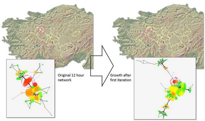
Mapping the growth of land-route networks across Anatolia
Mr. Stephens will collaborate with the CAST team to undertake high resolution path modeling and network analysis to investigate routeways emerging and in use in Anatolia in the Early Iron Age (ca. 1100-800 BCE), following the collapse of the Hittite state ca. 1200 BCE. This work will support the PIs... More Info
- PI: Lucas Stephens
- Institution: University of Pennsylvania
- Region: Near East
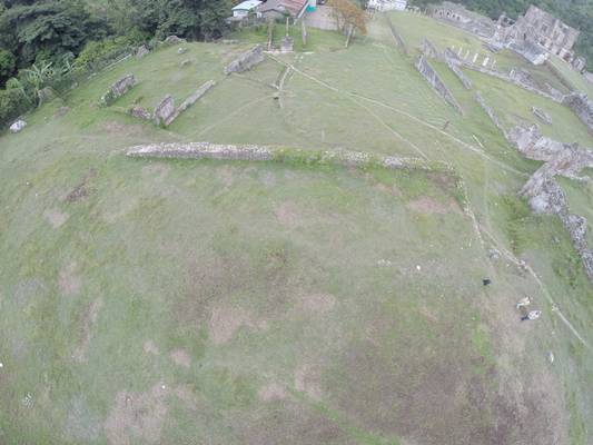
Modeling Royal Architecture at Sans Souci, Haiti: 3D Scanning and Photogrammetry at a UNESCO World Heritage Site
CAST researchers will be collaborating with Dr. Monroe and Mrs. Rocourt to collect new 3D scanning and photogrammetric data of the standing architecture at San Souci, Haiti to generate a high resolution architectural and topographic plan of the site. The collection of this data is crucial to the PIs... More Info
- PI: Cameron Monroe
- Institution: University of California – Santa Cruz
- Co-PI: Monique Rocourt
- Instituion: Institut de Sauvegarde du Patrimoine National
- Region: Caribbean
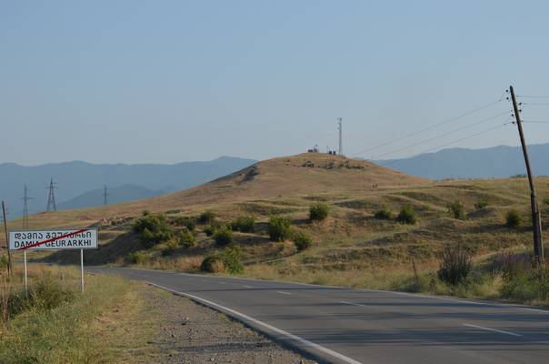
Craft Production and Technological Change at Fortress Sites in the South Caucasus, c. 1500-500 BC
Through this collaborative project, Mr. Erb-Satullo and members of the SPARC team will carry out geophysical surveys at Mtsvane Gora (Republic of Georgia). The project aims to identify and understand the spatial distribution of metallurgy activities and extra-mural settlement at the site. The el... More Info
- PI: Nathaniel Erb-Satullo
- Institution: Harvard University
- Co-PI: Dr. Jason Ur
- Instituion: Harvard University
- Region: Caucasus
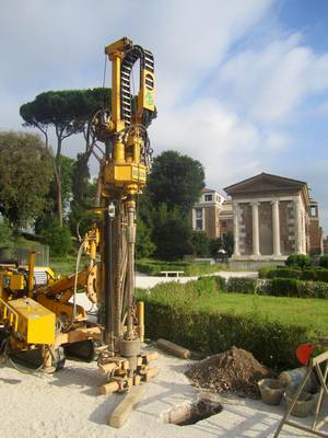
Reconstructing the Environment and Topography of the Forum Boarium in Rome
Together with SPARC researchers, Ms. Brock will use newly acquired data from her coring survey to build a digital model of the temple complex at Sant’Omobono (Rome, Italy) and the adjacent Tiber River harbor. By reconstructing the natural and built environment of this area, the team will expl... More Info
- PI: Andrea Brock
- Institution: University of Michigan
- Region: Mediterranean Europe
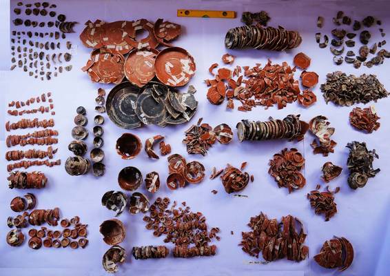
Marzuolo Archaeological Project: Crafting Innovation and Community in The Roman Countryside
Drs. Vennarucci, Van Oyen and Tol will work with SPARC researchers to implement a digital recording system for the excavations at Marzuolo, a rural production site located in Tuscany, Italy. Supported through pre-fieldwork and on-site collaboration, the team at Marzuolo will establish a method f... More Info
- PI: Rhodora Vennarucci
- Institution: University of Arkansas
- Co-PI: Astrid Van Oyen and Gijs Tol
- Instituion: Cambridge University and University of Groningen
- Region: Mediterranean Europe
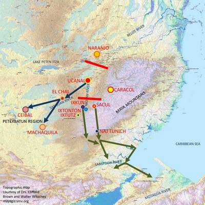
Five Lands Geospatial Project
Dr. Carter, together with Ms. Santini and Mr. Davenport, will collaborate with SPARC researchers to study the relationships between terrain, routeways, and evolving settlement patterns in the Five Lands region during the Classic period of Maya culture history. The project will assess the relatio... More Info
- PI: Dr. Nicholas Carter
- Institution: Harvard University
- Co-PI: Ms. Lauren Santini, and Mr. Bryce Davenport
- Instituion: Harvard University and Cultural Site Research and Management
- Region: Central America
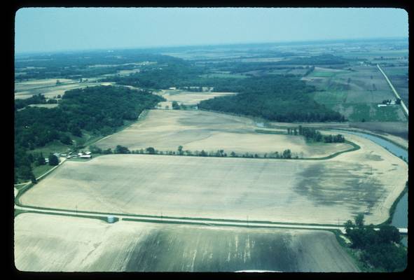
Geospatial Analytics at Gast Farm, a Multicomponent Site in the Upper Mississippi River Valley
Drs. Green, Whelan, Doershuk, and Swanson will be collaborating with SPARC researchers to develop a GIS and integrate the diverse data collected through their ongoing investigation of Gast Farm, a 13-hectare prehistoric site complex located in southeast Iowa. This site is important for the under... More Info
- PI: William Green
- Institution: Beloit College
- Co-PI: Susan Swanson, Mary Whelan, and John Doershuk
- Instituion: Arizona State University, University of Iowa
- Region: North America
2015
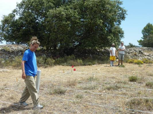
Data-fusion of a multi-instrument geophysical survey of an Iron Age Iberian/Roman settlement
Wendy Cegielski (ASU), with co-PIs Justin Rego and Ignacio Grau-Mira will be collaborating with SPARC researchers to investigate the structure and organization of the urban, Iberian fortified settlement of Mariola in Eastern Spain. Mariola’s occupation spans the 2 and 1 centuries BC, a period m... More Info
- PI: Wendy Cegielski
- Institution: Arizona State University
- Co-PI: Justin Rego and Ignacio Grau-Mira
- Instituion: University of Alicante
- Region: Mediterranean Europe
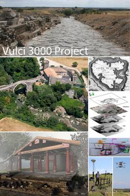
Vulci 3000
Vulci 3000 is a multidisciplinary project of archaeological research, training and digital communication focused on the Etruscan site of Vulci in central Italy. At many Etruscan sites archaeological research has focused on the necropoleis and funerary contexts. This research orientation has br... More Info
- PI: Dr. Maurizio Forte
- Institution: Duke University
- Co-PI: Dr. Nevio Danelon
- Instituion: Duke University
- Region: Mediterranean Europe
The Gault Site 41BL323
The Gault Site (421BL323) is a multi‐component site with virtually every interval in the regional prehistoric record represented. Deposits in different parts of the site result from various mixes of anthropic and geologic processes (fluvial, colluvial, aeolian) as well as pedogenesis. At th... More Info
- PI: Dr. Michael Collins
- Institution: University of Texas at Austin
- Co-PI: Dr. Bruce Bradley
- Instituion: Texas State University
- Region: North America
Malthi Mapping and Digitization Project
Malthi provides a nearly unique example of a fully excavated Middle Hellenic (MH) settlement. The excavated remains include a series of houses, storage facilities, entrance ways, and possible public architecture, enclosed by a settlement wall. Malthi is perhaps the first MH site at which a major... More Info
- PI: Rebecca Worsham
- Institution: UNC Chapel Hill
- Co-PI: Donald Haggis and Michael Lindblom
- Instituion: UNC Chapel Hill and Uppsala University
- Region: Mediterranean Europe
Understanding Rejolladas and Examining their Potential for Predicting Settlement Location at Tahcabo
Professor Patricia McAnany and Maia Dedrick of UNC Chapel Hill and Dr. Adolfo-Iván Batún-Alpuche (AGEY) will be collaborating with SPARC researchers to seeks to identify the size and distribution of rejolladas (limestone solution sinkholes) on commonly held ejido land surrounding the town of ... More Info
- PI: Patricia McAnany
- Institution: UNC Chapel Hill
- Co-PI: Maia Dedrick
- Instituion: UNC Chapel Hill
- Region: Central America
2014
Measuring Household Economies in Iron Age Southwest Jordan: An Archaeological Case Study from Edomite Busayra
Anthropological archaeologists have long sought to document and explain how the economies of past societies responded to imperial rule. Scholars have paid particular attention to the ways indigenous economies reacted under the stress of imperial demands for tribute and market demands for new or ... More Info
- PI: Benjamin Porter
- Institution: University of California, Berkeley
- Region: Near East
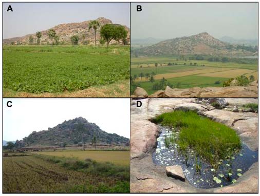
Biodiversity as a Social Process: Land Use, Resource Consumption, and Near-surface Geophysical Explorations at South Indian Iron Age-Early Historic Settlements
Dr. Andrew Bauer of the University of Illinois will be collaborating with SPARC researchers to carry out near-surface mapping of magnetic anomalies as part of a broader interdisciplinary project designed to examine the related social and natural histories of the understudied inselbergs (island mount... More Info
- PI: Andrew Bauer
- Institution: University of Illinois
- Region: India
Identification of Coarse Earthenware Potters on Production and Consumption Sites in Charlestown, Massachusetts Using Fingerprint Biometric Identification
Joseph Bagley and Jennifer Poulsen of the Boston Landmarks Commission will be collaborating with SPARC researchers to use a structured light scanner to create detailed 3D models of ceramic artifacts featuring finger and hand prints from the Parker-Harris Pottery Site and Three Cranes tavern Site in ... More Info
- PI: Joseph Bagley and Jennifer Poulsen
- Institution: Boston Landmarks Commission
- Region: North America
Lidar data acquisition and landscape archaeology for the Caribbean island of Montserrat
The Survey and Landscape Archaeology on Montserrat project began in 2010, and Drs. Ryzewski and Cherry have been conducting pedestrian survey for four field seasons. The dense vegetation and steep terrain of this island preclude intensive, systematic survey and ground visibility is extremely poor... More Info
- PI: Krysta Ryzewski
- Institution: Wayne State University
- Co-PI: John Cherry
- Instituion: Brown University
- Region: Caribbean
Etruria Before and After the Roman Conquest. The Landscape of Vulci.
Over a thousand archaeological sites have been identified in the landscape around Vulci, located north of Rome in Italy through a variety of surveys and excavations. Through this SPARC supported project, researchers from SUNY Buffalo and Accademia Nazionale dei Lincei - Rome will be bringing this... More Info
- PI: Orlando Cerasuolo, Erin Warford, Stephen Dyson
- Institution: SUNY Buffalo
- Co-PI: Luca Polcinelli
- Instituion: Accademia Nazionale dei Lincei - Rome
- Region: Mediterranean Europe
Evaluating Competition Beween Chaco-Style Great Houses in the Southern Cibola Region of West-Central New Mexico
Kristin Safi's project aims to investigate the social mechanisms operating within great house community organization and inter-community interaction that served to integrate and differentiate multi-ethnic communities in the southern Cibola region of west central New Mexico. With SPARC support... More Info
- PI: Kristin Safi
- Institution: Washington State University
- Region: North America
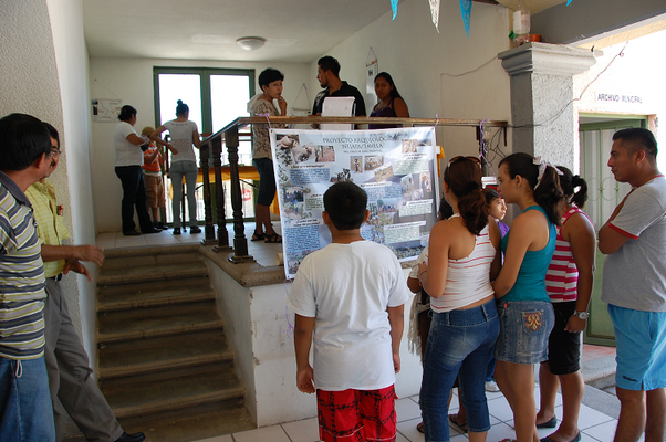
A 3D Digital Collection and Virtual Exhibit for Santa Ana Tavela's Community Museum
Stacie King will be developing a workflow and protocol to model and virtually display objects from a community museum collection in Santa Ana Tavela, Mexico, using structure from motion style photogrammetry and an open source, lightweight approach to virtual museums. This project aims to bring in... More Info
- PI: Stacie King
- Institution: Glenn A. Black Laboratory for Archaeology, Indiana University
- Region: North America
Modeling Long-Term Water Management Strategies on the Irrigated Plain of Miān-āb, in the Khuzistan Province of Iran. Type of Application:
Mehrnoush Soroush's project attempts to understand the longue durée water management strategies on the irrigated landscape of Miān-āb, in the Khuzistan Province of Iran. Using historical aerial photographs and declassified Corona imagery she plans to create a historical DEM and carry out hydro... More Info
- PI: Mehrnoush Soroush
- Institution: New York University
- Region: Near East
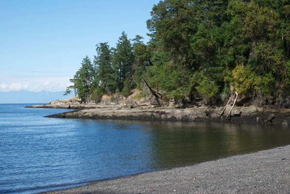
The economic organization of a pre-contact Northwest Coast village
Patrick Dolan and Colin Grier will be using magnetometry survey to collect essential data on the organization of domestic space and households at the Dionisio Point Site in the Gulf Islands, British Columbia. This data will be used to support the broader study of economic indicators of hous... More Info
- PI: Patrick Dolan
- Institution: Washington State University
- Co-PI: Colin Grier
- Instituion: Washington State University
- Region: North America
Bosutswe Landscapes: Exploring early African towns through geophysics and photogrammetry
Drs. Klehm and Ernenwien will be using geophysical and airborne thermographic survey to study three small rural sites in Botswana, with the aim of expanding our understanding of the local social, political, and economic landscape around the polity site of Bosutswe, the central site for this area... More Info
- PI: Carla Klehm
- Institution: University of Washington St. Louis
- Co-PI: Eileen Ernenwein
- Instituion: East Tennessee State University
- Region: Africa
|
|
|
|
|